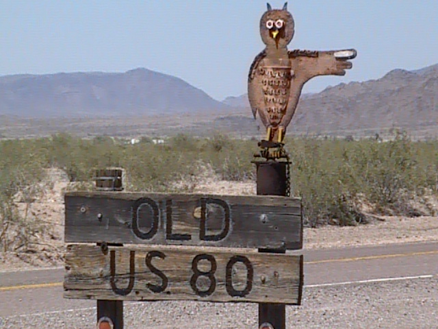
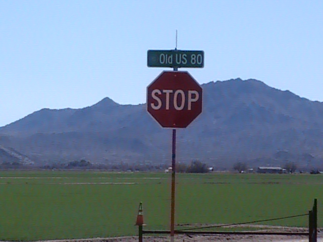
Old U.S. Highway 80
Fast Flight Facts
Target Species: Sandhill Cranes, Raptors, waterbirds in flooded fields
Elevation: 830'
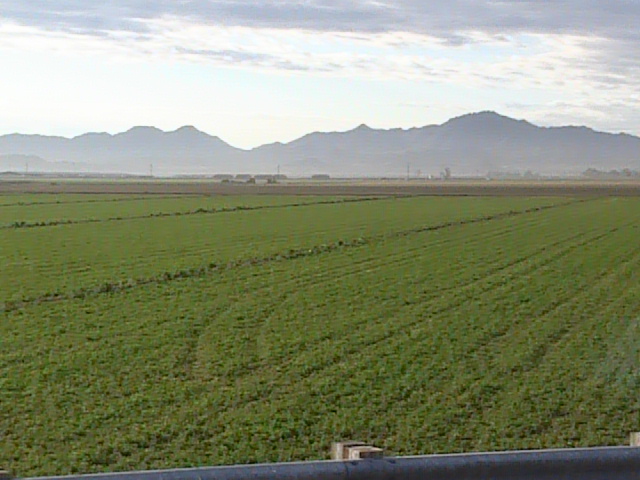
Habitat: Agricultural fields that are often flooded
Overall Birding Rating: 4
Difficulty: 1 (Easy)
Birding Type: Car Birding, Stopping and Scanning, Get out and Scan, Simple Walking
Facilities: None
Fees/Ownership: None/Public road (a lot of private property near road)
Closest Town or City/How far from Phoenix: Buckeye, Gila Bend /33.6 miles southwest of Phoenix
Getting there: Reached from Highway 85 to the north and I-8 to the south by Gila Bend
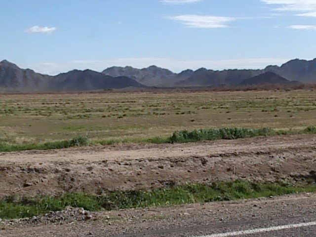
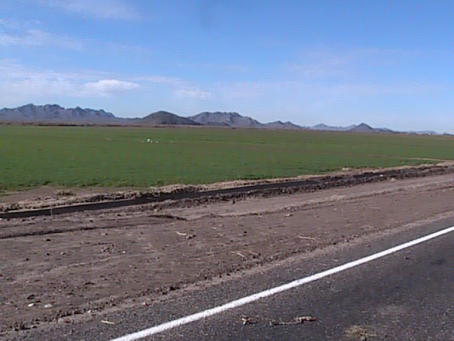
Overview: If your up for birding all day from a car, then take the nice route and a peaceful drive down the Old U.S. Highway 80. This highway runs for 35 miles which passes by Palo Verde and Arlington before continuing all the way south to Gila Bend. It is an excellent route to take for car side birding, as a majority of the birding stops are agricultural fields and open areas which provide days with amazing numbers of abundant raptors in the winter months. This route also passes close by to many other nearby hotspots that are only minutes off the Highway 80. In this description and summary of this route, roads will also be included that go off the Highway 80 for a relatively close distance as part of the area. There are good roads with excellent habitats that can be driven in short loops that come right back to the highway.
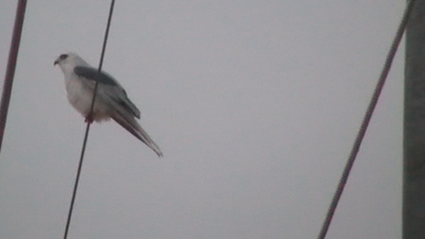
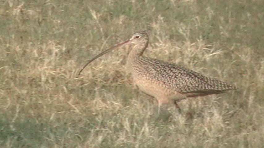
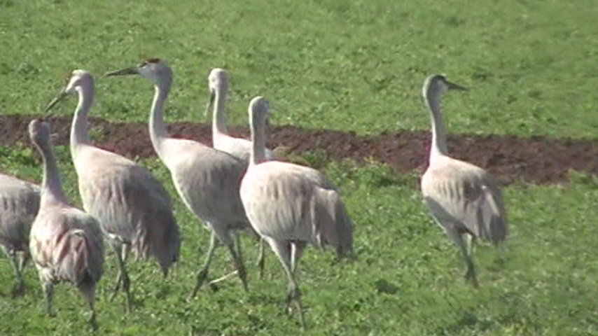
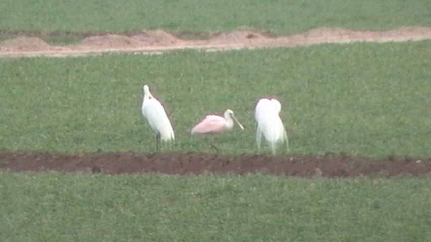
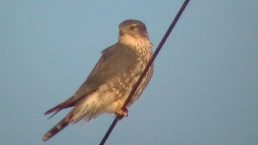
Birdlife can be very interesting along the Old Highway 80 mainly where the agricultural areas are, with the winter months clearly being the best time to bird in this area. The main bird attractants here for birders would be the raptors. This is the best place in Maricopa County to view the White-tailed Kite. These beautiful raptors are very kestrel-like, as they hover over the field when they are hunting continuously. Finding them can be another story, as the birder needs to be in the right place at the right time. Winter is the best time for the White-tailed Kites, even though they may be found year round. The open agriculture and fields also provide excellent opportunities to view multiple Ferruginous Hawks, which is an uncommon hawk in Arizona. Driving on the Old Highway 80 and the surrounding roads will increase the chances a lot more. Other raptors to see include very abundant numbers of Red-tailed Hawks, American Kestrels, and Northern Harriers, as well as Osprey, Bald Eagle, and Merlin. Another bird interest that this part of the county offers are flocks of wintering Sandhill Cranes which can be found up and down the highway through the winter months. The flocks can range from 2 birds to over 120 birds. Sandhill Cranes are very hard to find elsewhere in Maricopa County. The agricultural fields are also often flooded along this stretch, which attracts flocks of Long-billed Curlews and White-faced Ibis throughout the year. Herons are usually in the fields and along the canal lines. Look for all three egrets in the day (Cattle, Great and Snowy), which can often all be seen. It is also good to keep an eye out for sparrows in the winter months when driving along the fields, as they are good for Vesper, Lark, and Savannah Sparrows. Other birds to watch for along the Highway 80 stretch throughout the year and in season include Greater Yellowlegs (along with other shorebirds when fields are flooded), Common Ground-Dove, Greater Roadrunner, Belted Kingfisher, Black and Say's Phoebes, Vermilion Flycatcher, Western Kingbird, Loggerhead Shrike, Horned Lark, American Pipit, Barn Swallow, Lincoln's and White-crowned Sparrows, Northern Cardinal, and Red-winged, Yellow-headed, and Brewer's Blackbirds. Uncommon to rare birds seen along this highway have included a Roseate Spoonbill and a light-morph Harlan's Hawk.
Birding Routes and Stops: If accessing the Old Highway 80 from the north most point, that is the best route to begin. If coming south on Highway 85, the actual turnoff to the Old US Highway has been closed for sometime, with the detour being on Hazen Road, which is just north of the old turnoff to the 80. Turn right (west) onto Hazen Road and continue west to Wilson Avenue. Take a left at Wilson (south), until you reach the Old Highway 80. Once you reach the highway, turn right (west) which the Highway 80 goes all the way south to Gila Bend. By turning east, it comes to a dead end quickly, but good habitat is still on this short east side of the Highway 80/Wilson Avenue intersection. ALSO-when you turn west onto Hazen Road, there shortly is a grove of nice cottonwood trees bordering a farmed area along Hazen Road that might be worth checking for warblers and other goodies during the year, especially in migration.
As you are continuing west shortly along the Old Highway 80, there are two very good loop drives along both the north and south side of the road that come right back to the highway. One loop consists of the Old Highway 80 bordering the north, with W. Narramore Road bordering the south (just north of the Gila River), as S. Paloverde Road borders the east and S. 307th Avenue borders the west. S. Bruner Road runs in the middle of the east and west border roads. This is often a very productive loop for many different species in the agricultural areas. The second loop is directly adjacent and north of the first loop and takes the birder through agriculture as well as several ponds that are usually productive. This time, the Old Highway 80 borders the south while Lower River Rd borders the north. S. Palo Verde Road borders the east and S. 309th Avenue borders the west, which runs slightly west of the other loop to the adjacent south. S. Bruner Road runs between the border roads here as well too. Driving on Lower River Roads takes the birder to the Lower River Road Ponds, another productive birding hotspot to add ducks, geese, shorebirds, and other birds that are associated with water to the day list. These areas and loops just off the Highway are very productive and should be explored, with good possibilities of White-tailed Kites, Ferruginous Hawks, and Sandhill Cranes.
As one finishes up this area and starts to head west down the highway again, the Old US 80 then starts to turn in a southwest curve for several miles before passing by the Salome Highway, which taking this Highway a few miles to the northwest will eventually lead to The "Thrasher" Spot at Baseline Road/Salome Highway. For a few miles, the agricultural habitat ends, but once one gets to Arlington and the Arlington Valley, the good agricultural habitat is reached once again with another good driving loop right off the 80. For this next loop, there are two roads that go off to the east from the highway, Cactus Rose Road to the north, and Desert Rose Road to the south for the north and south borders. Either one is good to start on. The Old Highway 80 is the western border while S. Arlington School Road is the eastern border. This area is excellent as well for Sandhill Cranes and raptors. Fields are also flooded regularly here which attract White-faced Ibis and Long-billed Curlews. Just southeast of the intersection of Desert Rose and Arlington School Roads is the Arlington Wildlife Area, another excellent birding location. Also as you follow the eastern border of this loop, S. Arlington School Road all the way north past the north border, Cactus Rose Road, it goes shortly to Arlington Canal Road, which will run northeast shortly before strictly turning east, and is immediately south of Highway 80. It eventually turns into Arlington Road. By following this road as well, equal birding opportunities are presented. You can take 331st and 319th Avenues north to get back to Highway 80.
Once finished with the loop in the Arlington Valley Area and back on Old Highway 80, the highway will then turn in the southeast direction for awhile, before it turns sharply in the east direction. As it turns sharply, a long and old rustic bridge is encountered. While driving on the bridge, it passes over the Gila River, and on the north side of the bridge, is Gillespie Dam, another good birding hotspot located right off the Highway 80.
South of Gillespie Dam the road of the Highway 80 goes through one more stretch of good agriculture, which is by mile markers 15 and 16. It presents good opportunities like the other spots did, although there really aren't any side roads to drive off the highway and explore. It is always possible to see a large amount of Sandhill Cranes here as well. South of here it is relatively scrubby desert and birdlife is a lot more scarce. Still scan the roadside poles for raptors until Gila Bend is reached.
Birding Tip: Birding along the Old U.S. Highway 80 really requires patience and a lot of scanning if an extra good outing is desired. Many birds stay hidden in grass and fields that have taller vegetation, and a lot of raptors can be found be patiently scanning. Sometimes it is helpful to park roadside and scan, as you may find a lucky patch where many birds are present.
Directions: Take the I-10 freeway west to Highway 85, and drive south until Hazen Road is reached. Follow Hazen shortly west to Wilson Avenue, take Wilson Ave. south to the Old US Highway 80, and then continue west along the many good stops directly on or just off the highway.
Pages:
Old U.S. 80 Maps
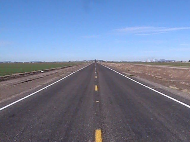
Scenes and Sights from the Old U.S. Highway 80:
Birdlife of the Old U.S. Highway 80:
White-tailed Kite
Long-billed Curlew
Sandhill Crane
Roseate Spoonbill (rarity) with Great Egrets
Merlin
Back to Area 8-Arlington to Gila Bend |


