Old U.S. 80 Maps
*All maps property of Google.
Map # 1: Accessing the Old Highway 80
Take the I-10 to the Highway 85 exit towards Gila Bend. Go south on Highway 85 for about five miles before reaching Hazen Road on the west side of the road. Once at Hazen, go west on Hazen for two miles, and then south on Wilson Road for 0.5 mile to access Old Highway 80. The Old Highway 80 is 35 miles in length, 33 of them west of the Wilson intersection, over two to the east. From Wilson, the two miles east can be productive at times too.

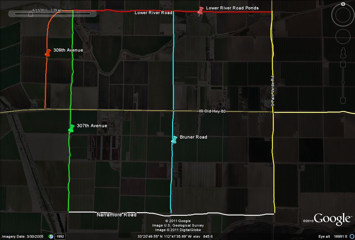
Map #2: Productive loop drives along the Old Highway 80, set 1
As you are continuing west shortly along the Old Highway 80, there are two very good loop drives along both the north and south side of the road that come right back to the highway. One loop consists of the Old Highway 80 bordering the north, with W. Narramore Road bordering the south (just north of the Gila River), as S. Paloverde Road borders the east and S. 307th Avenue borders the west. S. Bruner Road runs in the middle of the east and west border roads. This is often a very productive loop for many different species in the agricultural areas. The second loop is directly adjacent and north of the first loop and takes the birder through agriculture as well as several ponds that are usually productive. This time, the Old Highway 80 borders the south while Lower River Rd borders the north. S. Palo Verde Road borders the east and S. 309th Avenue borders the west, which runs slightly west of the other loop to the adjacent south. S. Bruner Road runs between the border roads here as well too. Driving on Lower River Roads takes the birder to the Lower River Road Ponds, another productive birding hotspot to add ducks, geese, shorebirds, and other birds that are associated with water to the day list. These areas and loops just off the Highway are very productive and should be explored, with good possibilities of White-tailed Kites, Ferruginous Hawks, and Sandhill Cranes.
Map # 3: Productive loop drives along the Old Highway 80. set 2
For this next loop, there are two roads that go off to the east from the highway, Cactus Rose Road to the north, and Desert Rose Road to the south for the north and south borders. Either one is good to start on. The Old Highway 80 is the western border while S. Arlington School Road is the eastern border. This area is excellent as well for Sandhill Cranes and raptors. Fields are also flooded regularly here which attract White-faced Ibis and Long-billed Curlews. Just southeast of the intersection of Desert Rose and Arlington School Roads is the Arlington Wildlife Area, another excellent birding location. Also as you follow the eastern border of this loop, S. Arlington School Road all the way north past the north border, Cactus Rose Road, it goes shortly to Arlington Canal Road, which will run northeast shortly before strictly turning east, and is immediatetly south of Highway 80. It eventually turns into Arlington Road. By following this road as well, equal birding oppurtunities are presented. You can take 331st and 319th Avenues north to get back to Highway 80.

|


