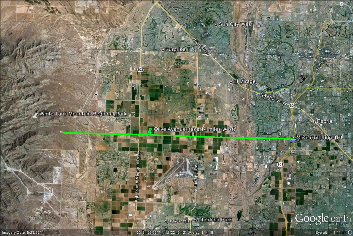
Map # 1: Getting to the White Tank Mountain Regional Park.
The White Tank Mountains are located west of Phoenix. The White Tank Mountain Regional Park is best reached by Olive Avenue, which eventually turns into White Tank Mountain Road, going through the park. If on freeways, the closest freeway to reaching the White Tanks is the Loop 101 west. Take the Olive Avenue exit and head west on Olive Avenue for 14 miles to the entrance of the park.