The "Thrasher" Spot Maps
*All maps property of Google.
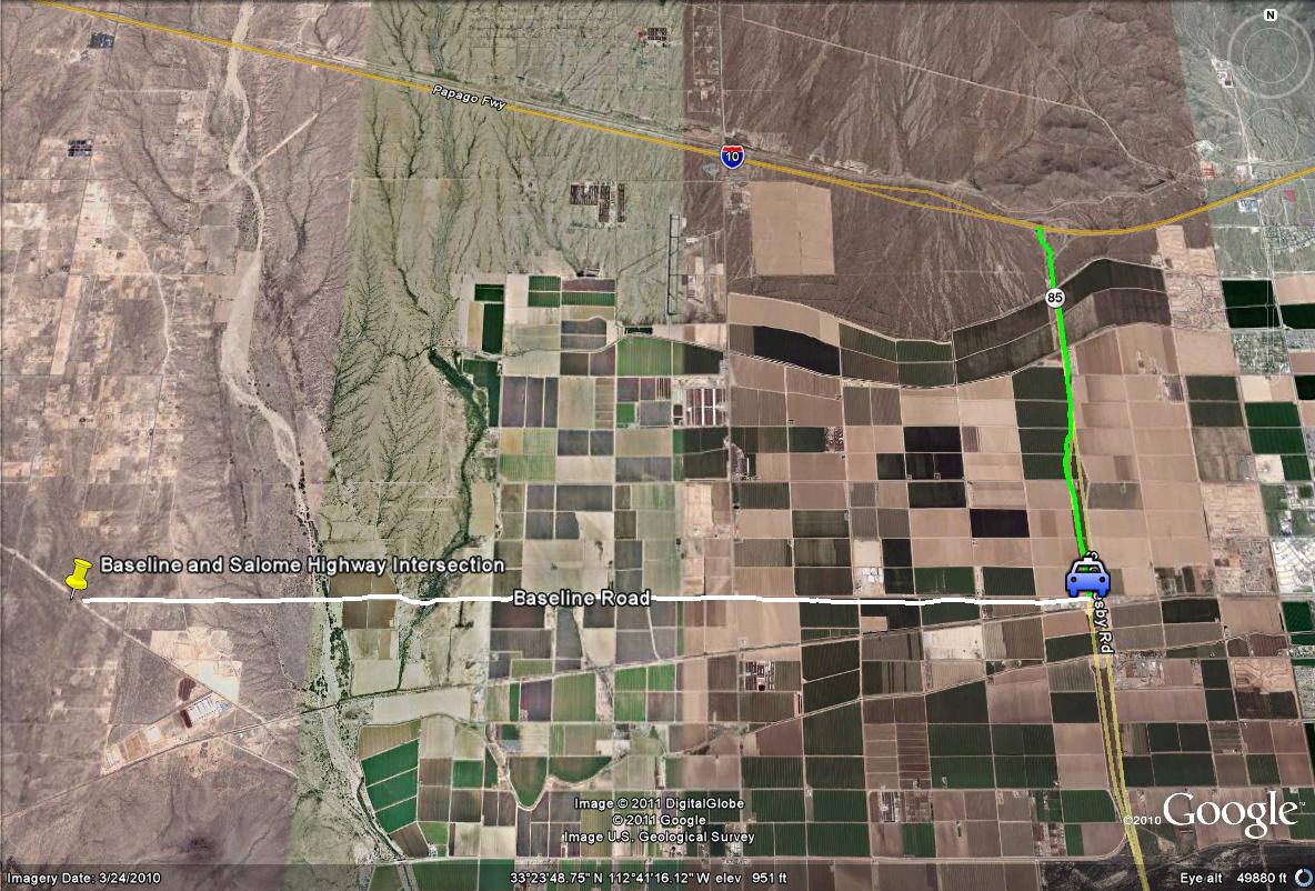
Map # 1: Overview of getting to the "Thrasher" Spot at Baseline Road and Salome Highway.
From the I-10, take the Highway 85 exit south towards Gila Bend for 3.5 miles until Baseline Road is reached on the west side of the highway.
Take Baseline Road west for just over eight miles until the road ends and intersects with the Salome Highway. Once here, park roadside and begin the thrasher search!
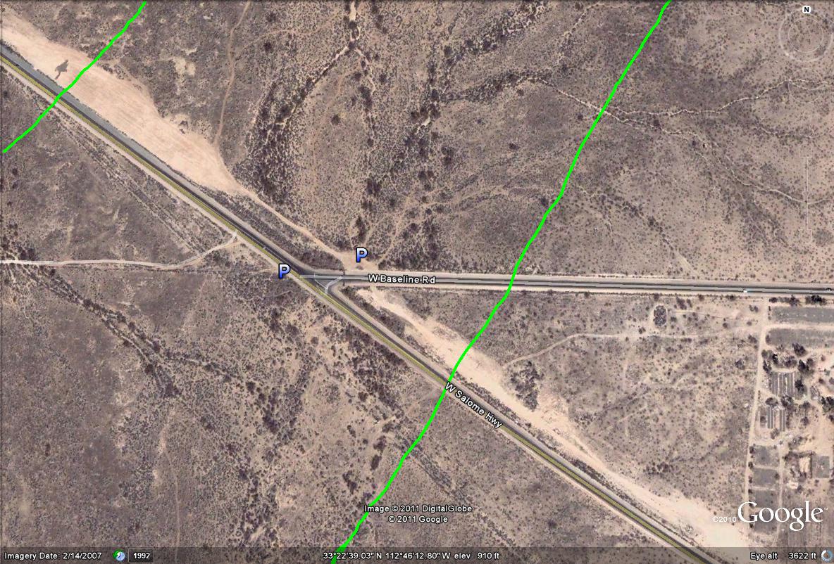
Map # 2: Overview of the "Thrasher" Spot at a closer look.
This illustrates parking areas and good general areas where the thrashers are very often seen. The normal parking is on the south side of the Salome Highway, and another good parking spot is on the north side of Baseline Road right before it ends and meets the Salome Highway. There is a dirt road that goes even further north than of the parking spot, and conceals the vehicle better. The green lines illustrate where the thrashers are most often seen, often by walking out directly from the parking areas. Between these two lines whether continuing northeast or southwest, this is the best bet for seeing thrashers, often without having to hike. Explore the area well outside of these lines too, which they are often seen as well. Both sides of the road are a good bet, but the south side tends to be more productive on most days.
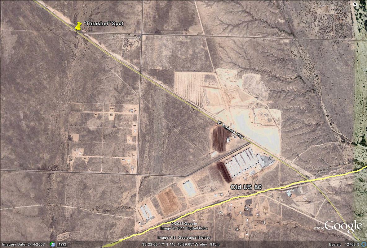
Map # 3: An alternative route to reach the "Thrasher Spot"
If exploring the birding areas and hotspots along the Old US 80, one will come across the Salome Highway when it intersects the Old US 80. Head in the northwest direction for about two miles on the Salome Highway to meet the Baseline intersection and get to the thrasher spot that way.
| 

