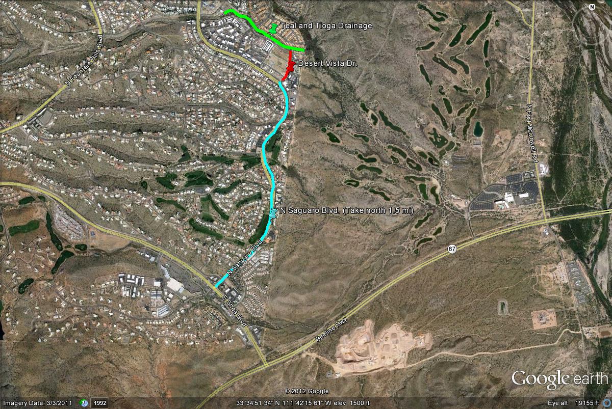
Map # 1: Getting to the Teal and Tioga Riparian Drainage.
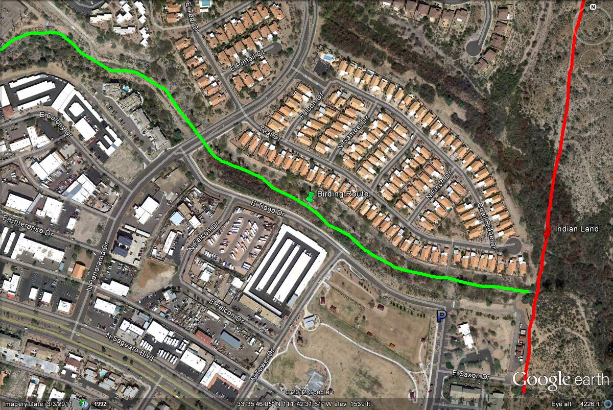
From the east side of Shea Boulevard (just west of Highway 87), take Saguaro Boulevard north for 1.5 miles in the direction of Fountain Hills Lake. There are several side roads, so keep a close eye out. This drainage can most easily be reached from Desert Vista Drive. At 1.5 miles, Desert Vista Drive will be a right turn (in the northeast direction). Head a short distance up Desert Vista Drive, where the Desert Vista Dog Park is located. Continue to the northmost section of the dog park and park. This is barely south of Tioga Drive. The riparian drainage is bordered by Tioga Drive on the south. Just north of the drainage are the line of houses represented by Teal Drive. By walking west down the drainage, it goes for about 0.8 miles through good habitat. Just east of the parking area and drainage access point is a fence which is the Indian Reservation line, be sure not to tresspass beyond that fence.
Map # 2: A closer look at the Teal and Tioga Riparian Drainage.