Sun Lakes Community Maps
*All maps by Google.
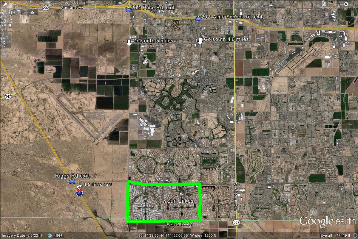
Map # 1: Getting to the Sun Lakes area.
As illustrated below, the best way to get to this location by a faster route would be by taking exits either off the 1-10 or the Loop 202. From the 1-10, take the Riggs Road exit and follow Riggs Road 1.5 miles east to the highlighted area. The other good option is by taking the Loop 202 (Santan Freeway) to either the Price Road or Alma School Road exits. Take Price Road about 5 miles south to the highlighted area, and Alma School Road 4.6 miles south to the area.
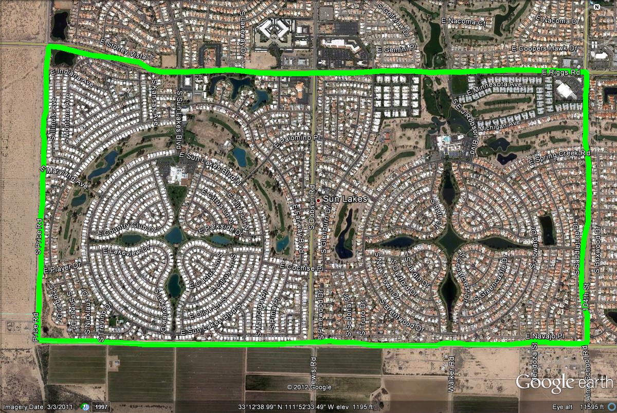
Map # 2: Overview of the Sun Lakes main neighborhoods that are good for birding.
Once coming from either the 1-10 or the Loop 202 Freeways, Riggs Road is the first road one will reach, which is the northern border to this area. This area has many different access points regardless of which border you are on. On this map (and the two maps below this map), the directions and overviews will refer to an east and west side to this spot, divided in half by Dobson Road.
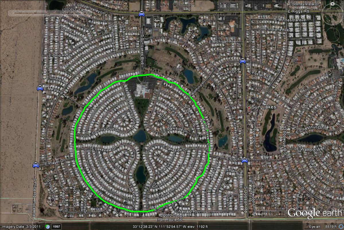
Map # 3: The west side of the Sun Lakes Community.
As mentioned above, these next two maps will give close up looks at these different ponds and access points on the west and east sides of Sun Lakes. By looking at the "blue car" icons, these will show the easier access points to reach this area. The east border in Price Rd. will have two access points, Maryland Ave. and Player Dr. Riggs Road on the north border has Sun Lakes Blvd as it's best access point. Sun Lakes Blvd continues in a circular motion, which this road circles entirely around the ponds. By finding a parking lot anywhere around here, the ponds will be accessed close by. The east border of this section is Dobson Road, where Palomino Pl. and Cochise Pl. are the easiest access points. Cochise Pl. is actually a good place to access both the west and east sides from Sun Lakes if on Dobson Rd.
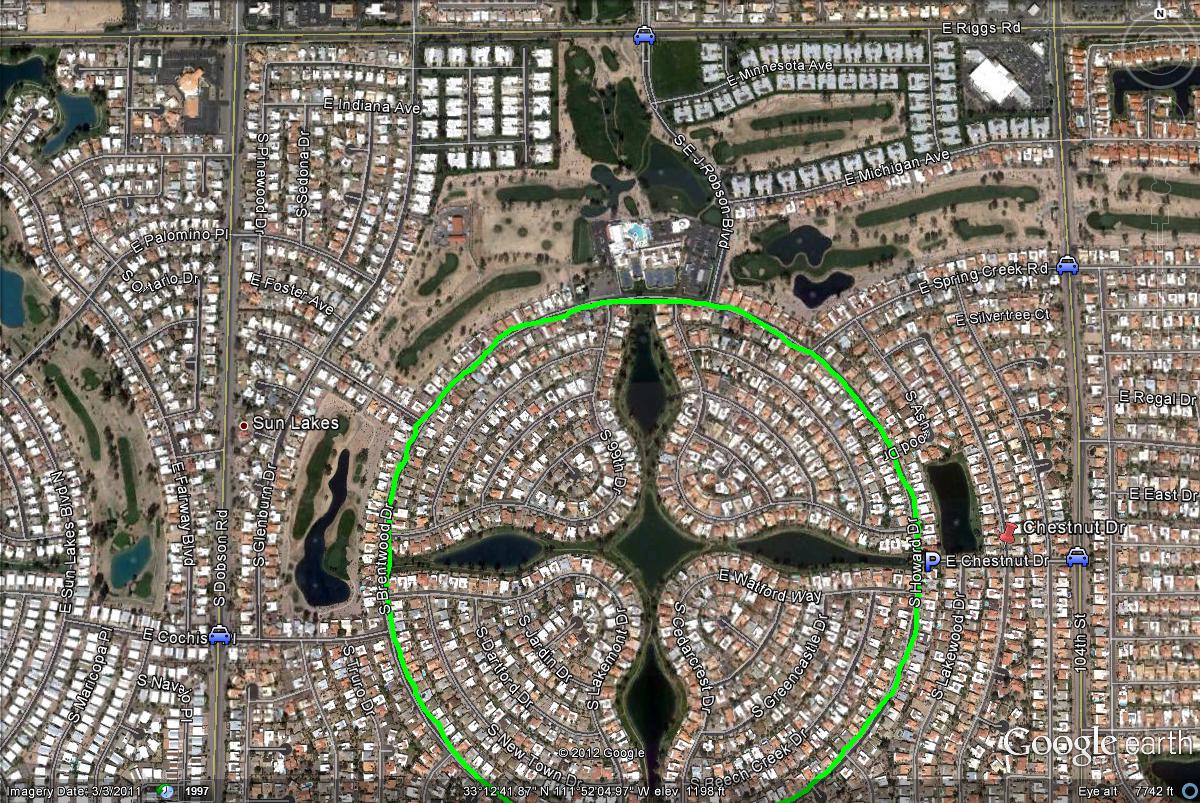
Map # 4: The east side of the Sun Lakes Community.
This is the close overlook of the east side of the Sun Lakes Community. It's very similiar to the west side, with a circular road circliing around a section that features five different ponds. This circular road is Howard/Brentwood Drive, where parking areas should be easily found to access these ponds. If coming south on Alma School Road (the east border of this east section), take Chestnut Drive shortly west. Once reaching Howard/Brentwood Drive, there is a conveniant place to park right by that intersection of Chestnut and Howard. Park there and explore these five ponds. Another good road to access Howard/Brentwood Drive from Alma School Road is Spring Creek Road. If on the north border of this section, Riggs Road, take E J Robson Blvd. south to Howard/Brentwood. The west border, Dobson Road, the best access point to Howard/Brentmore is Cochise Pl. By studying this map and looking at the "blue car" icons, this place should be accessed easily.
| 

