Roosevelt Lake Recreation Area
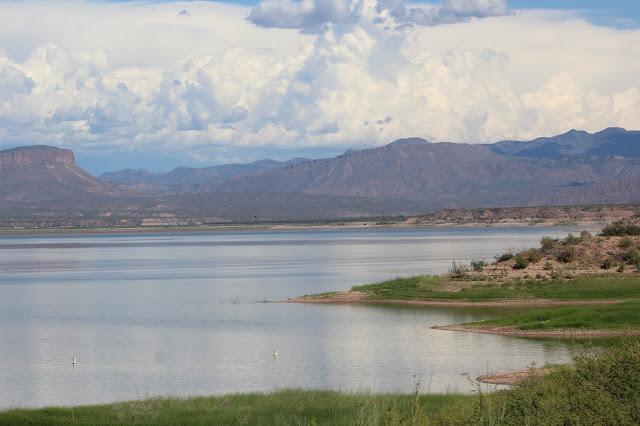
Roosevelt Lake, fully called Theodore Roosevelt Lake, is the largest reservoir that is entirely within Arizona (other larger reservoirs share their capacity with neighboring states). It is part of the SRP project on the Salt River, and is formed by Theodore Roosevelt Dam. The dam itself is a popular, historic landmark. Roosevelt Lake lies within the Tonto National Forest, and the recreation sites within the lake are under the jurisdiction of the Forest.
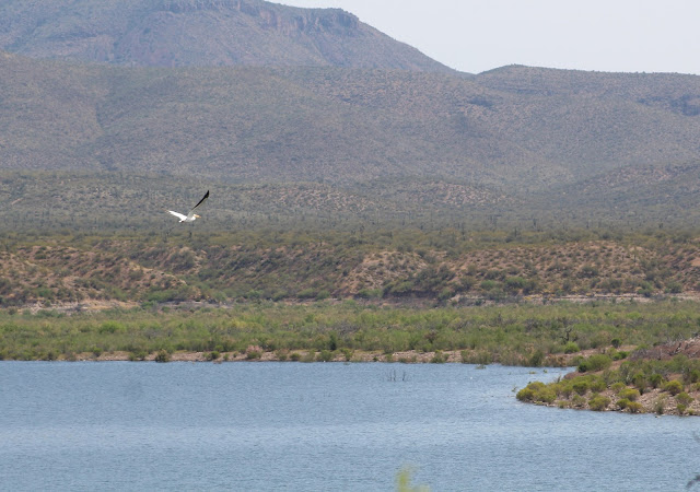
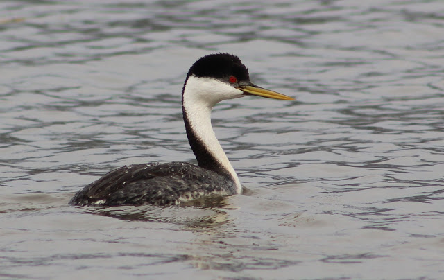
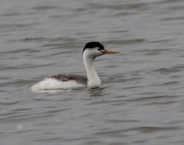
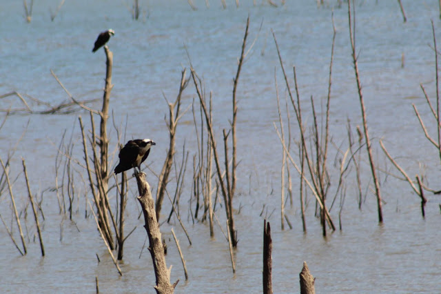
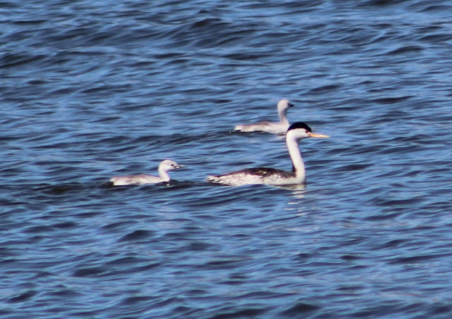
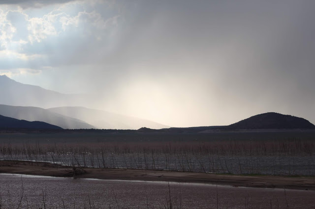
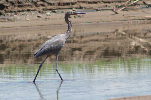
Roosevelt Lake is 23 miles long, and it can consume a day to accurately bird it's vast waters. The Salt River and Tonto Creek are two expansive water sources that flow into the lake. Other than a tiny portion of Maricopa County that lies in the lake near Theodore Roosevelt Dam, the rest of the Lake is completely in Gila County. Water levels may vary at different times of the year, which will have an impact of what birds may or may not be seen. Roosevelt Lake is the year round home to a variety of desert birds, nesting Bald Eagles, abundant Clark's and Western Grebes, as well as a variety of other waterbirds. Parts of the western shore and northern side of the lake are closed from November 15th through February 15th to protect nesting Canada Geese and other waterfowl. Ducks and geese, American White Pelicans, grebes, loons, shorebirds, gulls, terns, and more will show up throughout the year, with spring and fall migrations as well as winter hosting the widest varieties of birds. When water levels are lower, the northern and southern-most reaches of the lake will attract more shorebirds, gulls, and terns. Desert habitats as well as a few riparian areas within this recreation area add more avian diversity beyond the main waterbird attraction.
Location basics: Roosevelt Lake Recreation Area lies within the Tonto National Forest. A Tonto Pass is needed to park at the recreation sites, which is $8 at nearby gas stations/stores, or $12 at several pay stations that are in recreation sites within Roosevelt Lake. While some recreation spots are open for camping and are simply supported by the Tonto Pass, established campgrounds with numbered campsites require a higher fee for camping. Each recreation site holds restrooms, and campgrounds hold higher amenities.
Directions: Roosevelt Lake is most easily accessed via Highway 188, which is accessed at the north at it's junction with State Route Highway 87, 15.8 miles south of Payson. Highway 188 is accessed in Globe at it's southern reach and junction with Highway 60, adjacent to Russell Road. Once the Highway enters the Roosevelt Lake Recreation Area, the reservoir will be on the east side of the highway for the entire length. The northern half of the reservoir parallels the highway for a length, while the southern half of the reservoir extends further southeast and away from the highway. For the southern half, recreation sites have roads that extend out to the lake. Refer to the write up of each recreation site below for further information.
Once Roosevelt Lake Recreation Area is accessed, the northernmost recreation site, Orange Peel, lies between mile markers 254 and 253 (if heading south) on Highway 188. The turnoff to the southernmost recreation site, Schoolhouse Point, lies between mile markers 236 and 235 (still if heading south).
Birding Locations to Roosevelt Lake via Highway 188:
-Orange Peel Recreation Site (turnoff located between miles 254 and 253 on Highway 188) is the first stop if covering all of the recreation sites within Roosevelt Lake. This spot is currently closed for parking and other amenities, but one can park at or near the gate and walk into the area. Orange Peel is a spot that will bring an added diversity to a day of birding at Roosevelt Lake. There are willow and cottonwood stands that can be hiked to along Tonto Creek to the east for good riparian birding, as well as mesquite stands, surrounding desert, and weedy areas. When Roosevelt Lake has higher water levels, it will flow into the Tonto Creek valley. In that case, a variety of waterbirds will be present in the high flow, and access to any riparian habitat becomes very limited.
-Bermuda Flat Recreation Site (turnoff located between miles 252 and 251 on Highway 188), a long-length site, is probably Roosevelt Lake's most productive overall for birding. It is extremely popular for camping year round outside of the annual Canada Goose closure for all recreation activities from November 15th through February 15th. Crowded tenures do limit some birding results, but this site tends to hold the highest variety of species. Look for grebes, loons, and other divers in the deeper waters. The far northern side of Bermuda Flat, which will feature mudflats and low pools during some years, attracts different shorebirds, dabbling and diving ducks, herons, gulls, terns, and more. Bermuda Flat has two different halves to it's site: the North Pasture and the South Pasture. Camping at Bermuda requires at Tonto Pass, unlike the higher priced passes within the campgrounds further south at the lake. During the Canada Goose closure, this recreation site can still be birded quite well from various pull outs along Highway 188.
-Cholla Recreation Site and Campground (turnoff located between miles 250 and 249 on Highway 188) is a good place to scan the lake as well as bird within the Sonoran Desert habitats that fill the recreation site and campground. The campground has 100 units. After pulling onto the Cholla entrance road, take a right towards the boat launch area. Go south past the boat launch road to a parking area. Good views of the lake can be obtained from here and one can scan Roosevelt Lake to the east and looking south towards Cholla Bay. If going back towards the main Cholla entrance road, continue right and north to the campgrounds. Desert birding is excellent within the campgrounds, and in season, scan the extensive White-crowned Sparrow flocks for rarer Zonotricia such as White-throated, Golden-crowned, and Harris's Sparrows. More views of the lake that can't be seen well from the boat ramp area can be obtained from the campground.
-Bachelor Cove (turnoff located between miles 249 and 248 on Highway 188) offers a well-elevated place to scan Roosevelt Lake close to Cholla Recreation Site. One may scan from the elevated view roadside or go down into the cove, which can be popular for campers.
-Vineyard Canyon Picnic Site (turnoff located between miles 247 and 246 on Highway 188) is a nice site with picnic tables and a restroom. For the birder, one may find a variety of desert birds in the landscape, and take a loop trail east of the picnic area for a short hike to get better views of the lake. The trail parallels Vinyard Canyon and it's cove before turning to the south. One can walk off from the trail in places to get better views of Roosevelt Lake while looking east and south towards the Mills Cove area.
-Lookouts before Theodore Roosevelt Dam crossing: Before one crosses the memorable bridge that parallels Theodore Roosevelt Dam, there are places between Vineyard Canyon and the dam where the birder can pull off roadside and scan Roosevelt Lake for various waterbirds.
-Visitor Center (turnoff located between miles 243 and 242 on Highway 188) is a short drive to the visitor center parking area while staying on the road until it dead ends. It is a good place to see desert species and scan the lake. The lake marina lies below the Visitor Center, and it's buoys and floating objects attract both cormorant species and large numbers of gulls. Getting into the Marina area requires a separate fee away from the Tonto Pass.
-Cottonwood Cove Picnic Area (turnoff located between miles 243 and 242 on Highway 188) is another nice picnic area. Take a trail to the east of the parking area/picnic area to the southeast. A large stretch of water may be scanned from here that can't be viewed well from the Visitor Center just to the north.
Windy Hill Recreation Site (turnoff located between miles 241 and 240 on Highway 188) offers several good places to scan Roosevelt Lake. Take the main entrance road for just over 2 miles to it's end at a boat ramp to scan an expansive part of the lake. One will scan west and north at this point. Before this ending part of the road, turn right (east) at a few spots if driving north into Windy Hill Recreation Site. These spots go into large parking lots and there are a few more boat ramps. Elevated slopes from these other parking lots near boat ramps give good overviews of Roosevelt Lake while looking out further east. Bird the surrounding landscape for desert birds and migrants in season. A campground is within this recreation site.
-Grapevine Group Site (turnoff located between mile markers 237 and 236 on Highway 188) has high viewpoints to get a good scan of the lake. Take the entrance road for over two miles to it's ending point at the boat ramp. Depending on water levels, one may scan to the northeast from above the boat ramp or be able to park below the boat ramp and walk along the shoreline. If heading north into Grapevine along the entrance road, look for a road that quickly turns left (west) into a parking lot just before (south of) the boat ramp. This is a large parking lot, go to the northwest part of the lot. Find a wide dirt path that is blocked to vehicles by a fence but the fence has an opening for hikers. Follow the trail out to the north to get extensive views of Roosevelt Lake from an elevated peninsula. This walk will also take one past Gravevine Point. From the northern end of the trail, one may scan Roosevelt Lake from all directions.
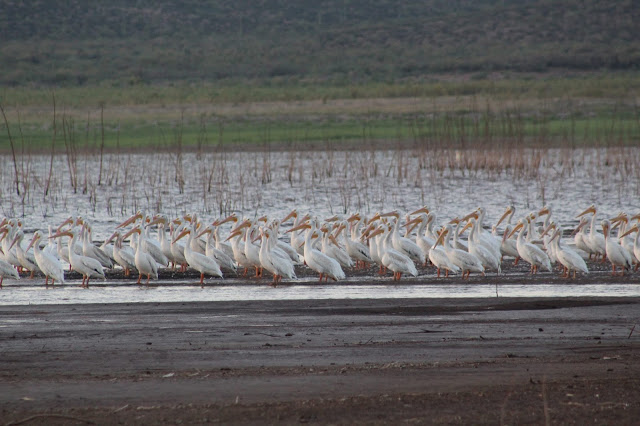
-Schoolhouse Point Recreation Site (turnoff located between mile markers 236 and 235 on Highway 188) is the southern-most of Roosevelt Lake's sites, and it is one of the best for birding. Take the road to Schoolhouse Point boat ramp and campground for about 4 miles. The boat ramp offers a good place to scan this southern stretch of Roosevelt Lake. Depending on water levels, one may be able to drive down to the end of the boat ramp and park, or continue on a dirt road that veers west near the base of the boat ramp. This dirt road is rough, but it gives one a good vantage point to scan the lake. If water levels are low, one may be able to walk along the shoreline of the lake for a considerable distance to the west. A variety of waterbirds: dabbling and diving ducks, loads of Western and Clark's Grebes, American White Pelicans, gulls, terns, shorebirds, herons, and more, congregate here throughout the year. If starting here early, one may have a productive bird list for the site with the habitat diversity this site has to offer. Back on the entrance road and south of the ending point is another paved road that veers east (2.5 miles north from Highway 188 turnoff). Take this road for a short distance until it dead ends. From here, take the old dirt road (closed to vehicle traffic) to the northeast. The intrepid birder will be taken through Sonoran desert habitat until some grassy habitat is reached. Following this main road as well as some branch off paths will take one further east to Roosevelt Lake and to the Salt River inflow into the reservoir.
Birding Locations on the east side of Roosevelt Lake (Access points away from Highway 188):
-Indian Point Recreation Site and Campground: This site is part of the Roosevelt Lake Recreation Area and is on the very northeastern section of the lake. It is the one developed Roosevelt Lake Site that is on the east side of the lake, away from Highway 188. Depending on water levels, the shoreline of this lake may be walked for a considerable distance during certain times of the year. It is a good place to scan the what may be very distant if scanning from Orange Peel and Bermuda Flat Recreation Sites. From the north side of Roosevelt Lake along Highway 188 adjacent to Orange Peel Recreation Site, head north on Highway 188 for 1.8 miles to A-Cross Road. Head east on A-Cross Road for 1.4 miles (depending on Tonto Creek water levels) and turn right to the south at the intersection. Stay on this road for another mile, and keep right and go toward the southwest on Indian Point Road for another two miles to the recreation site and campground. This location can also be accessed via Bar X Road if contining east past Tonto Creek there (depending on water levels) and turning south and right toward Indian Point and Roosevelt Lake.
Back to Gila County Birding Areas |


