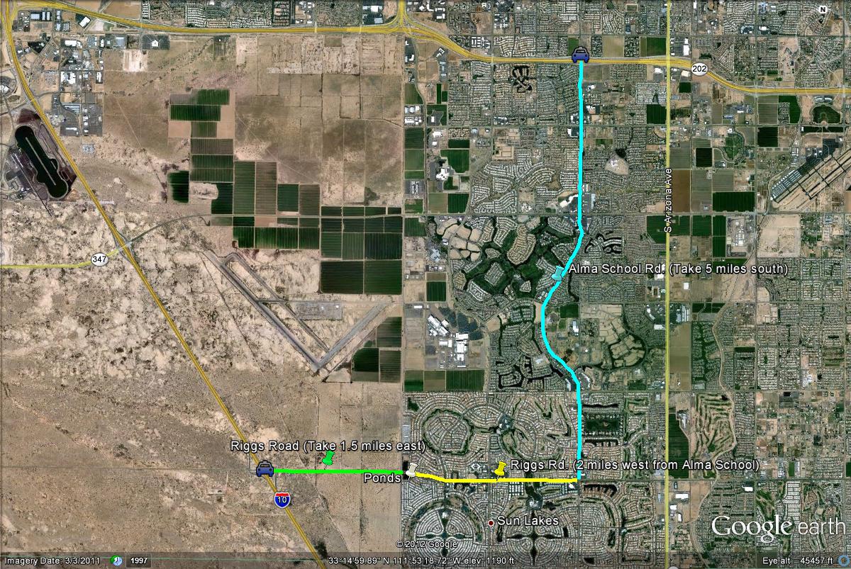
Map # 1: Getting to the Riggs and Price Roads Ponds.
If wanting to access these ponds from freeways, then there are two easier ways to do so from two different freeways. The first is the I-10 (Maricopa Freeway). Take Riggs Road 1.5 miles east from the I-10 to the intersection of Riggs and Price Roads. Head north a short distance on Price (left turn) where a small parking lot is located on the east side of Price Road. This is the Field of Dreams baseball field for seniors. The second option would be to exit off of the Loop-202 (Santan Freeway). Take the Alma School Road exit from the 202 and then head south on Alma School Road for 5 miles until Riggs Road is reached. Head west (right turn) on Riggs road for two miles until it intersects with Price Road. Turn right (north) on Price a short distance to the small parking lot. NOTE: Price Road is signed of by small signs and doesn't stand out as easily as one might expect. Watch for the two ponds when coming close to the spot. If you pass the signs for the Indian Reservation that is west of the ponds, then you've gone too far.
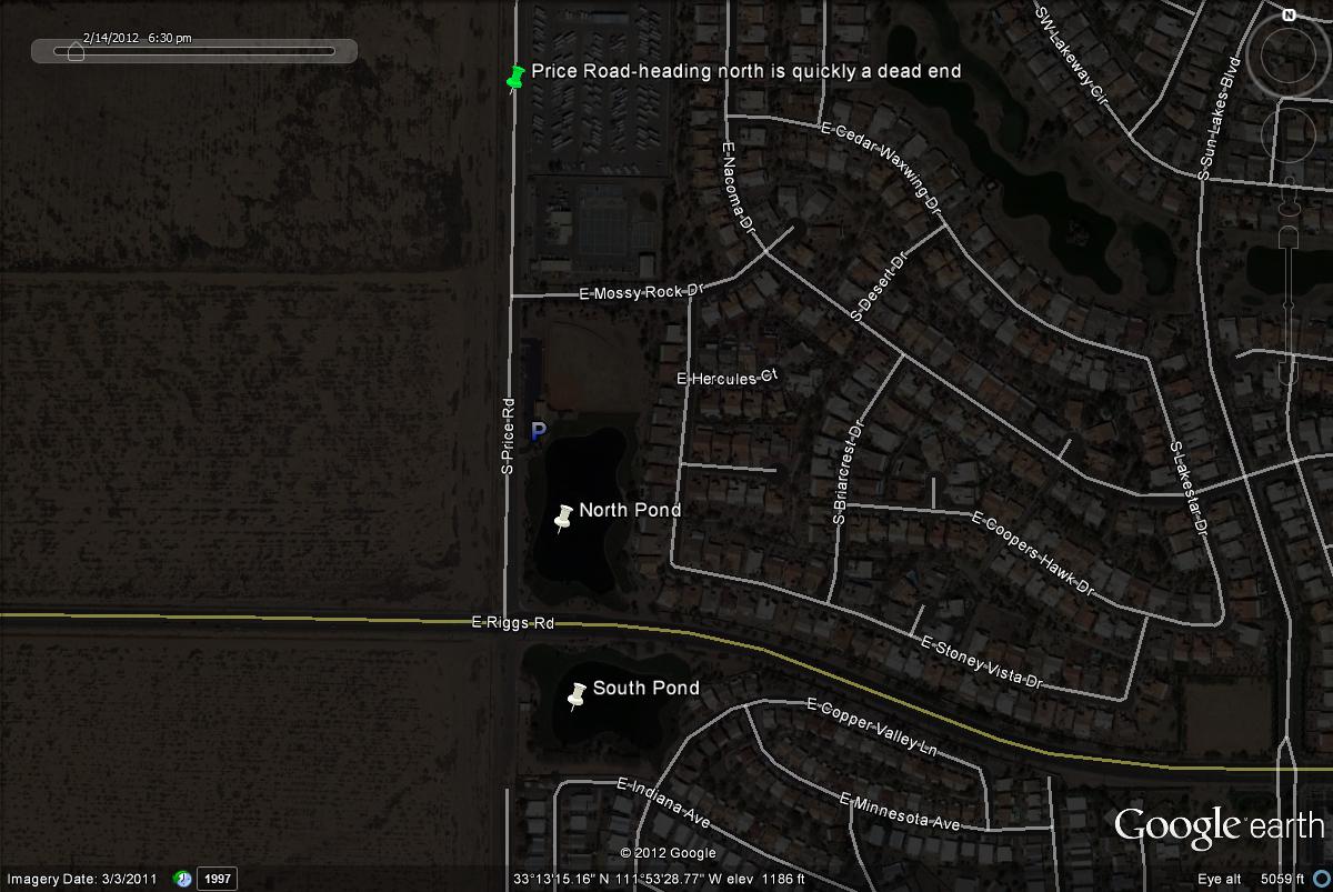
Map # 2: A closer view of the two ponds at Price and Riggs Roads.