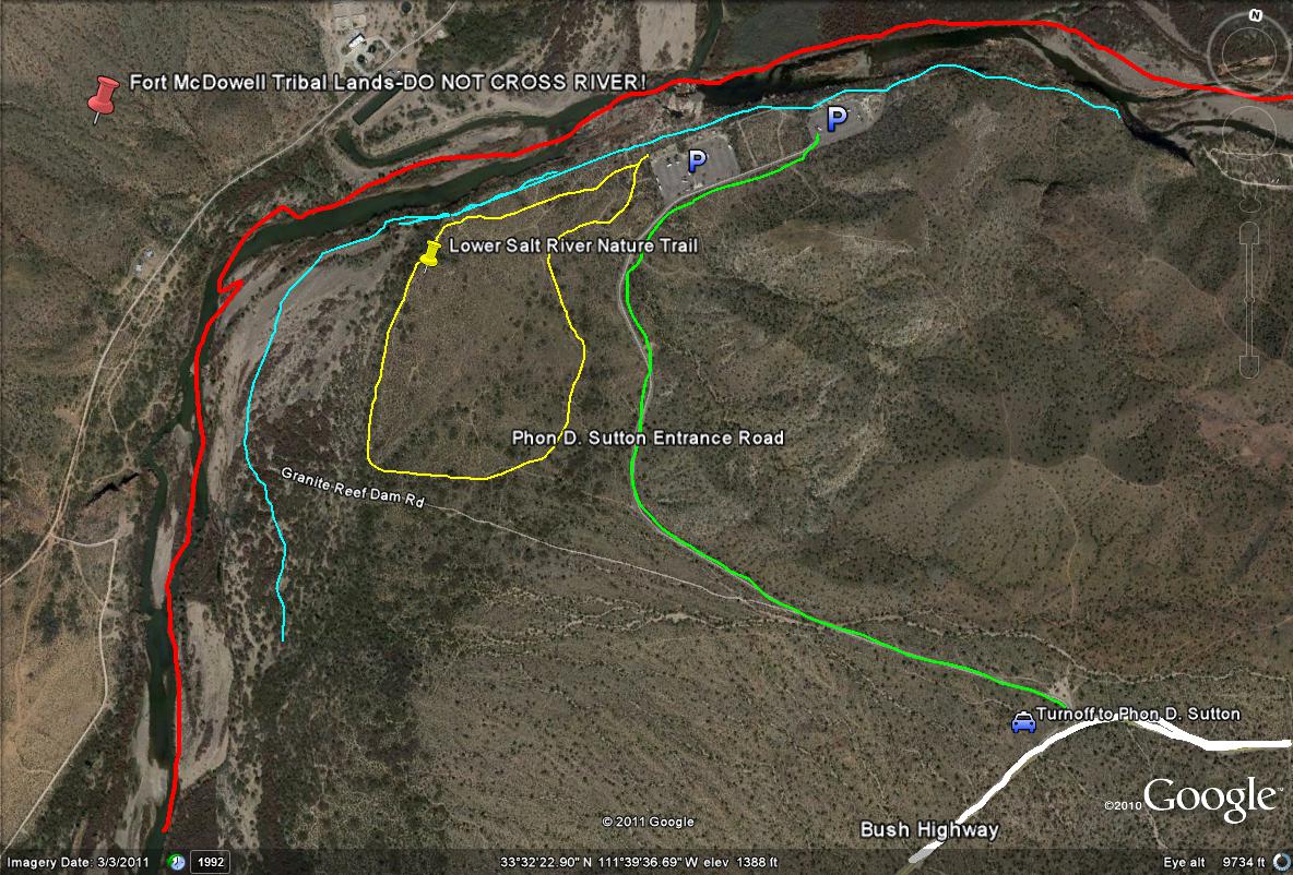
Lime-green line path: Shows the entrance road to access the Phon D. Sutton Recreation Site.
Light-blue line path: Shows the birding stretch of the area along the Salt River.
Yellow line loop path: This line shows a general illustration of the area in which the Lower Salt River Nature Trail is located, which is an excellent birding spot.
Red line path: Shows the boundary of the Fort McDowell Indian Tribal Lans. Don't cross and bird the other side of the river.