Paloma Ranch Maps
*All maps property of Google.
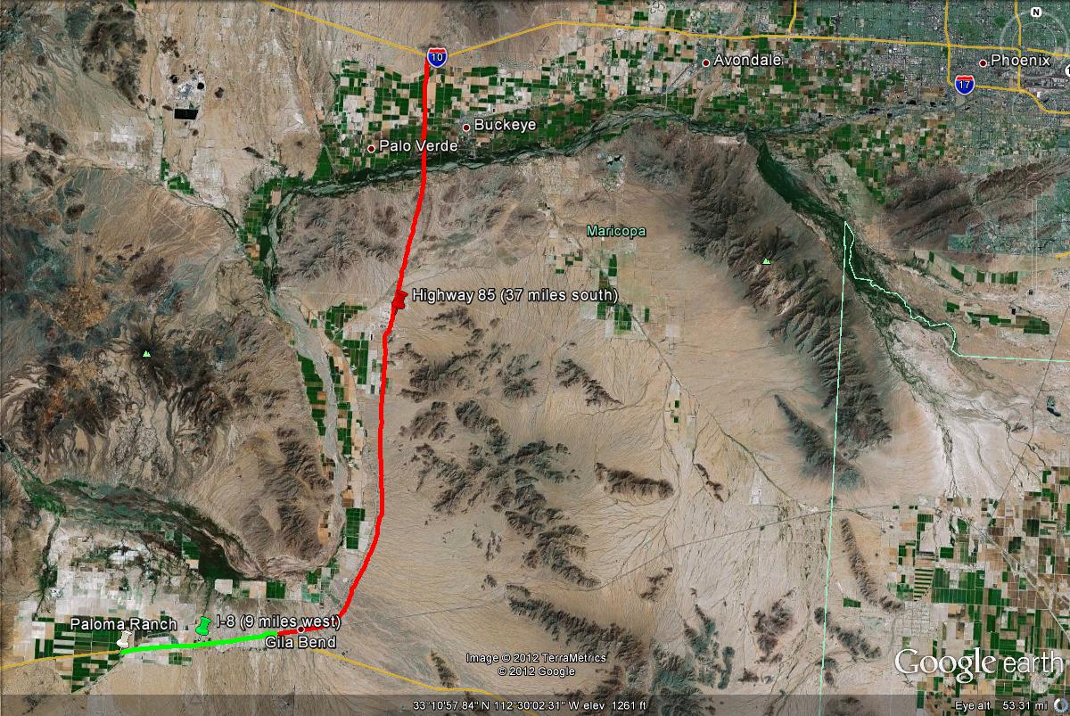
Map # 1: Getting to Paloma Ranch.
From the I-10 West (Papago Freeway), take the Highway 85 exit. Head south on Highway 85 for 37 miles towards Gila Bend. Then take I-8 west past Gila Bend for 9 miles to Paloma Road (which is exit 106). Once exiting the freeway, go south to the Frontage Road. Head west a short distance, where the Paloma Ranch headquarters will be noticeable. Cross the railroad crossing and park at the visitors parking lot near the office to gain permission to bird the headquarters. Take Paloma Road north from exit 106, which will intersect with Powerline Road. Expore the various dirt roads in this area, which can be accessed on both sides of the I-8. One of the better dirt roads is just north of the I-8, and runs for several miles east and west through good habitat. Also, when pulling into the headquarters on the south side of the I-8, head west on that dirt road as well. Several ponds can be found along the dirt road, which are often good for shorebirds. See the Paloma Ranch Maps page under the "Pages" section on this page.
Map # 2: Accessing the general Paloma Ranch area.
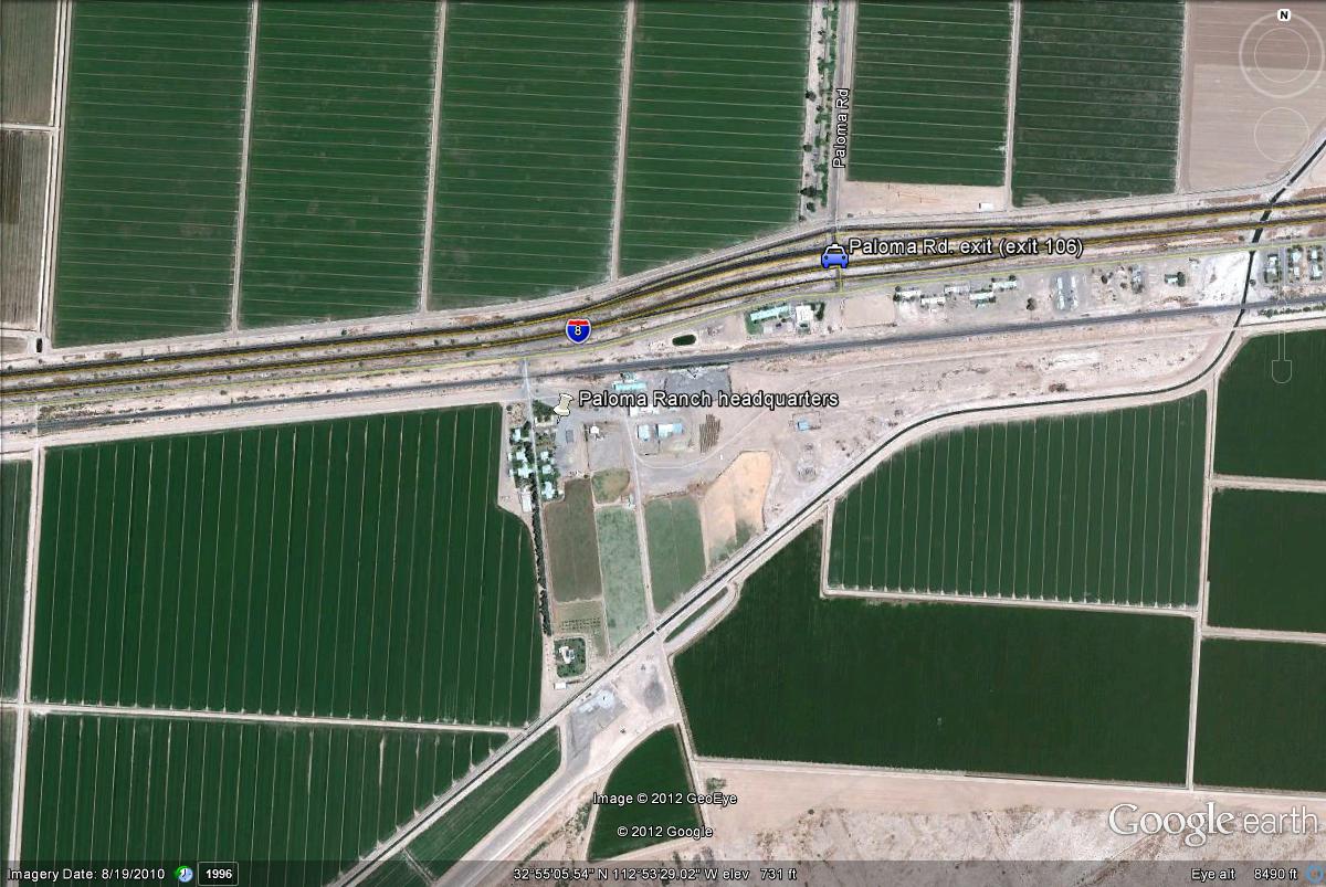
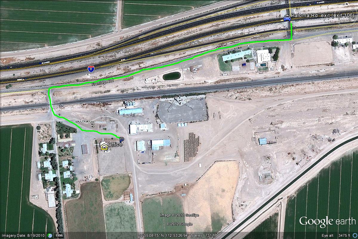
Map # 3: Parking and access to the headquarters.
To access the Paloma Ranch headquarters (a.k.a. the migrant trap), take the Paloma Rd. exit (exit 106) just south to the Frontage Road. Head west a short distance on the Frontage Road and turn south into the headquarters after crossing the railway. Find the office and park just east of the office in the parking area assigned to visitors.
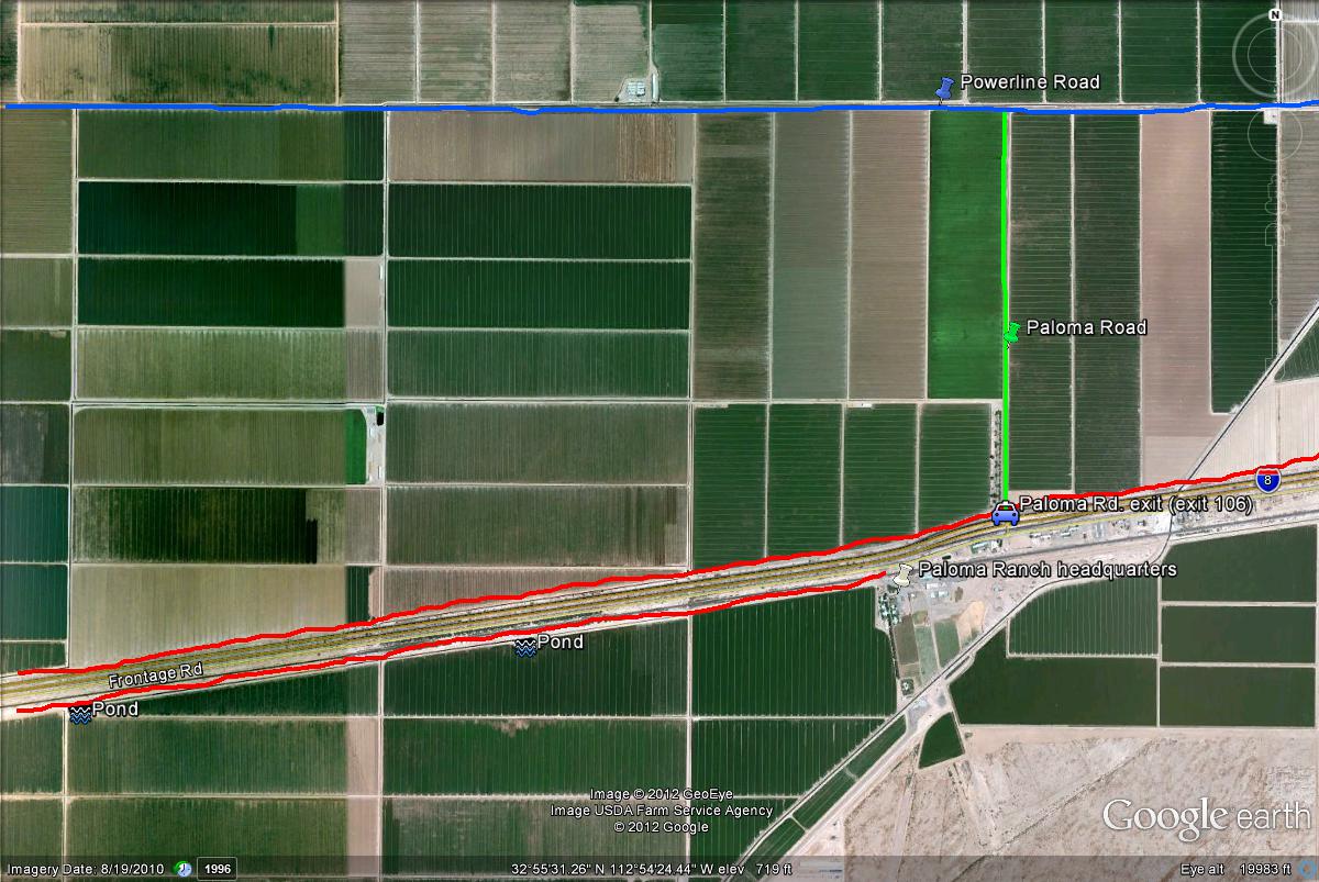
Map # 4: Exploring Paloma Ranch.
Much of Paloma Ranch is to be explored on away from the headquarters on both the north and south sides of Interstate 8. If going north of the I-8 on Paloma Road, head north to Powerline Road (which goes east and west directions). Using these two roads, explore the many side roads that run through the area. Also, just north of the exit and barely starting to drive north on Paloma Road, a dirt road runs all along the fields both east and west just north of the I-8. This is another good road (highlighted in red) to access differerent places at the area.
The other good place to access the agriculural areas at Paloma Ranch would be south of the I-8. This dirt road goes west (also highlighted in red), and is accessed after crossing the railway as if going into the headquarters. Head west on this road to scan the fields and ponds on this southside of the I-8. This dirt road is also barely south of the frontage road. Heading west along here will come across a few ponds (highlighted), which will have shorebirds in the right seasons if there are good waterlevels. Stop at the headquarters to gain permission to bird in the southside area of Paloma Ranch.
| 

