Neely Water Ranch Maps
*All maps property of Google.
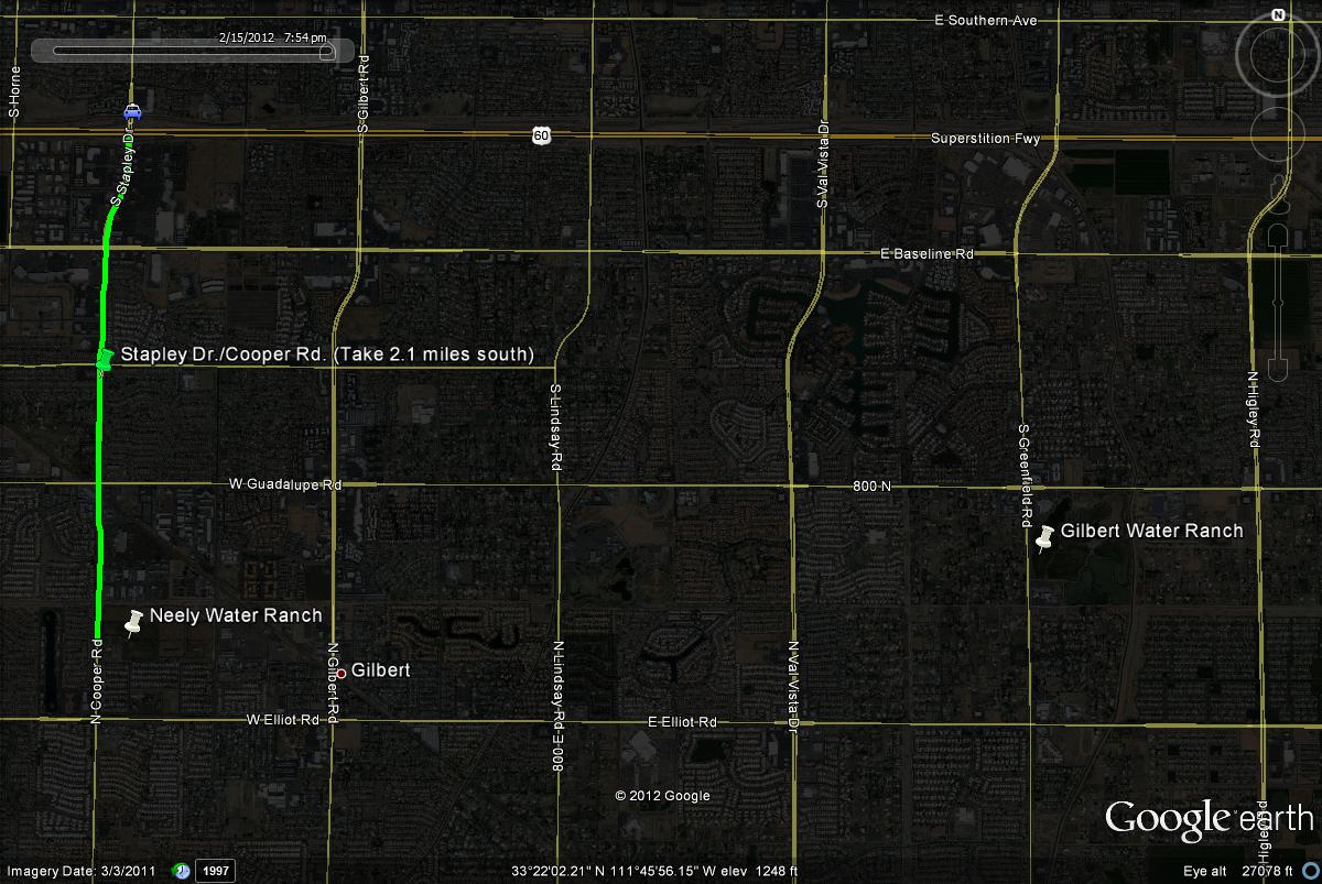
Map # 1: Getting to the Neely Water Ranch.
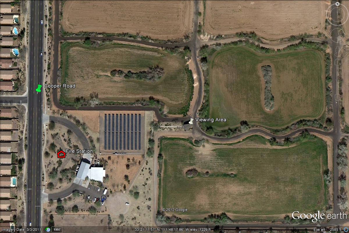
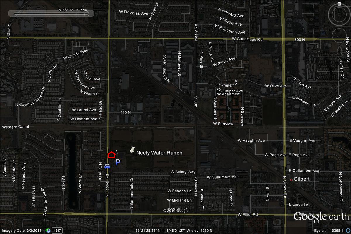
There are two freeway access points to reaching the Neely Water Ranch. One is from the Loop 101 (Price Freeway), at the Elliot Road exit. Take Elliot Road east for 5 miles to Cooper Road. Turn north on Cooper for a short distance to the Gilbert Fire Station on the east side of Cooper Road. The ranch is accessed from this fire station. A second freeway route: from the US 60 (Superstition Freeway), take the Stapley/Cooper Road exit. Head south for 2.1 miles where Stapley Drive turns into Cooper Road. After heading south past Guadalupe Road, the Neely Water Ranch overlook is accessed from the Gilbert Fire Station on the east side of Cooper Road. Turn into the fire station and park. From there, walk along the path and up to the overlook area of the basins. Three of the ponds can be viewed well from this platform. From the ranch, Elliot Road is the next big street, bordering this area shortly to the south. Neely Water Ranch is also close to Gilbert Water Ranch, only four miles west. Use Guadalupe Road if going to these two locations.
Map # 2: A closer view at accessing Neely Water Ranch.
Map # 3: Streets surrounding Neely Water Ranch.
| 

