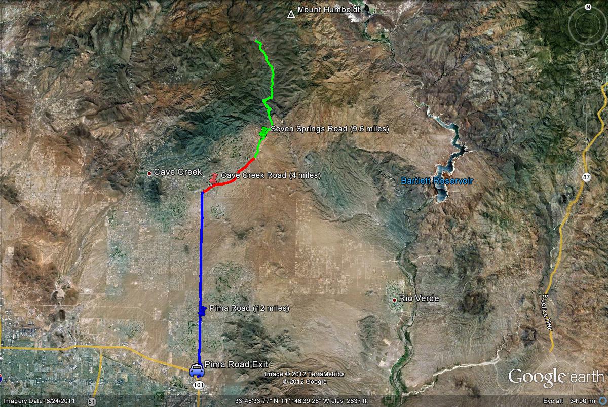
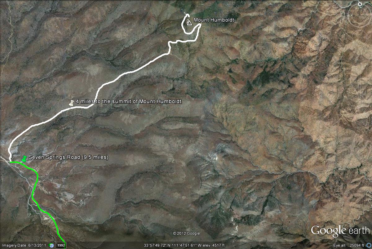
From the east side of the loop 101, take the Pima Road Exit and then Pima Road north for 12 miles until the intersection of Pima and Cave Creek Roads meet. Then take Cave Creek Road east for four miles until the road turns into Seven Springs Road. It becomes Seven Springs Road after the turnoff to the Cave Creek Ranger Station, which is where the daily passes may be purchased. Once it becomes Seven Springs Road, head north for 9.6 miles (after a short distance it becomes all dirt road) to the turnoff to the road that leads up to the mountain, which is unsigned but officially named, East Slate Highway 562. The turnoff to the road that leads to Mount Humboldt will be on the north side of Seven Springs Road. It is a noticable paved road. On another note, mile markers on Seven Springs Road correspond to the mileage when Cave Creek Road first turns into Seven Springs Road. This makes things a lot easier for birders, as they can easily follow the mile markers. The turnoff to Mount Humboldt will be between mile markers 9 and 10.