McCormick Ranch Area Maps
*All maps property of Google.
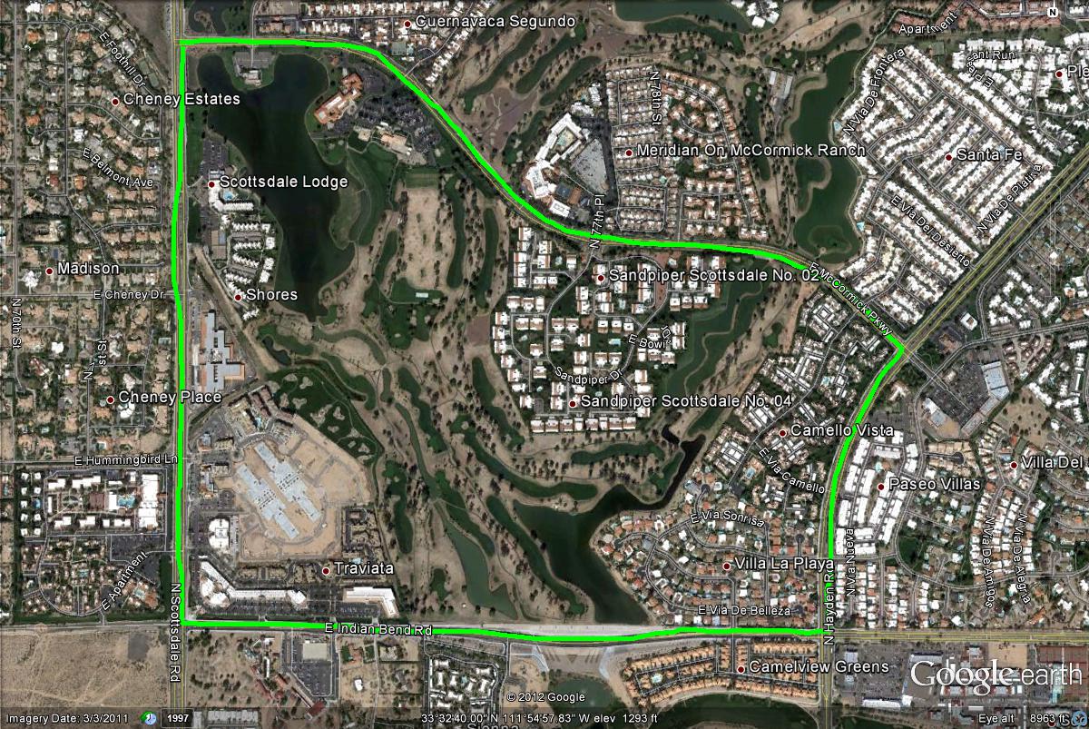
Map # 1: Getting to the McCormick Ranch Area.
The easiest freeway route in accessing the McCormick Ranch Area would be the Loop 101 East (Pima Freeway). From the 101, take the Indian Bend Road exit. Head west on Indian Bend Road for about two miles to reach this area. McCormick Ranch's ponds are very extensive beyond this page on this guide, but this guide covers more of the easier to access and popular ponds. The area described here is bordered four ways: Scottsdale Road on the west, McCormick Parkway on the north, Hayden Road on the east, and Indian Bend Road on the south. Driving around this border is 3.5 miles in length.

Map # 2: An overview of the McCormick Ranch Area
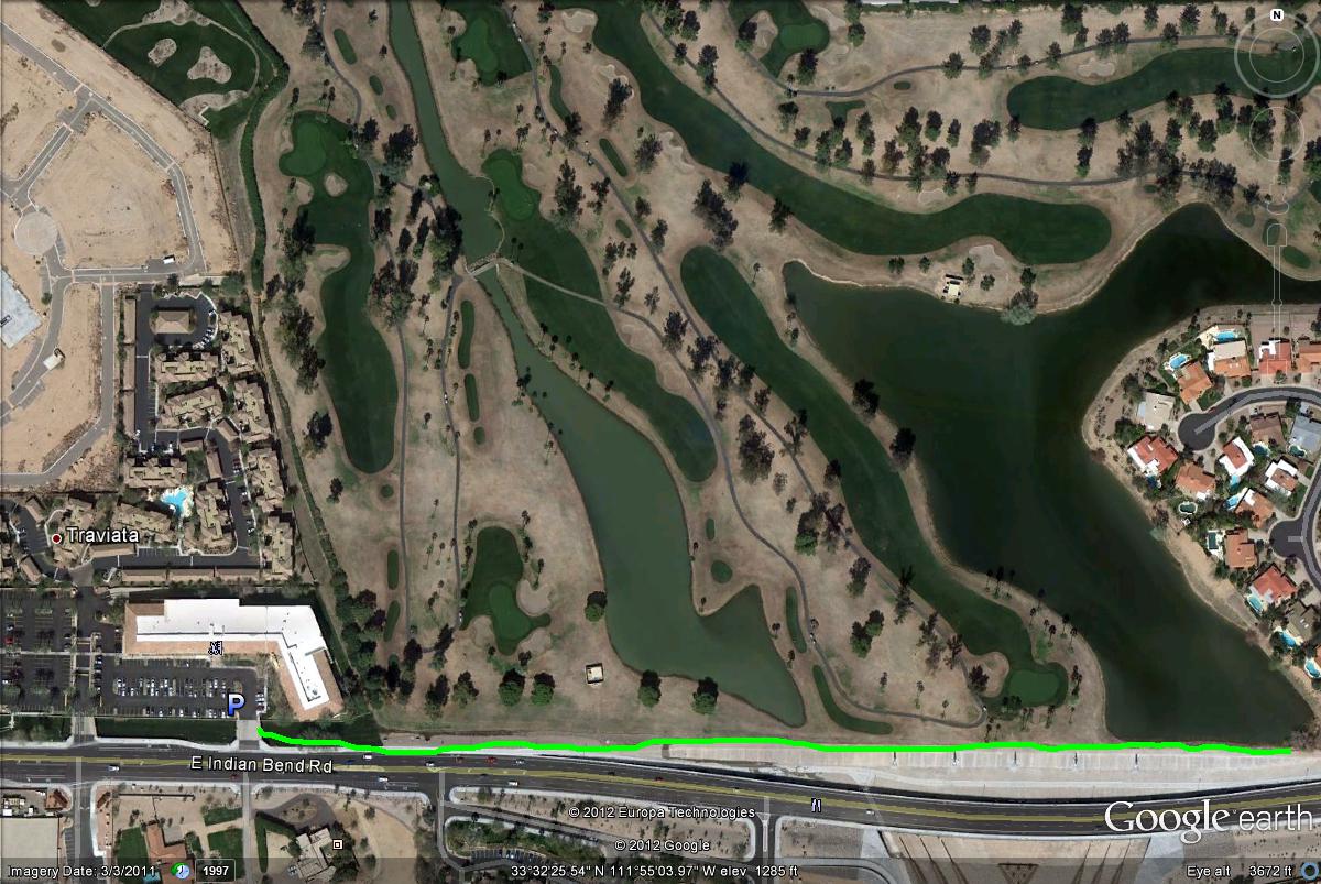
Map # 3: The two productive ponds that can be scanned from Indian Bend Road.
Often a good route to start with would be to continue west on Indian Bend Road after exiting off the 101. Go west past Hayden Road and continue a short distance west. Keep an eye out while crossing a bridge on the north side of the road. Two large ponds are noticeable from the road, which are on the north side of Indian Bend Road. Just west of these ponds are a business area where parking access is good. This business parking lot will be your first right turn (north) into the business parking lot. Park here and walk to the ponds on the concrete paths, and also avoid the golf course by staying on the public path.
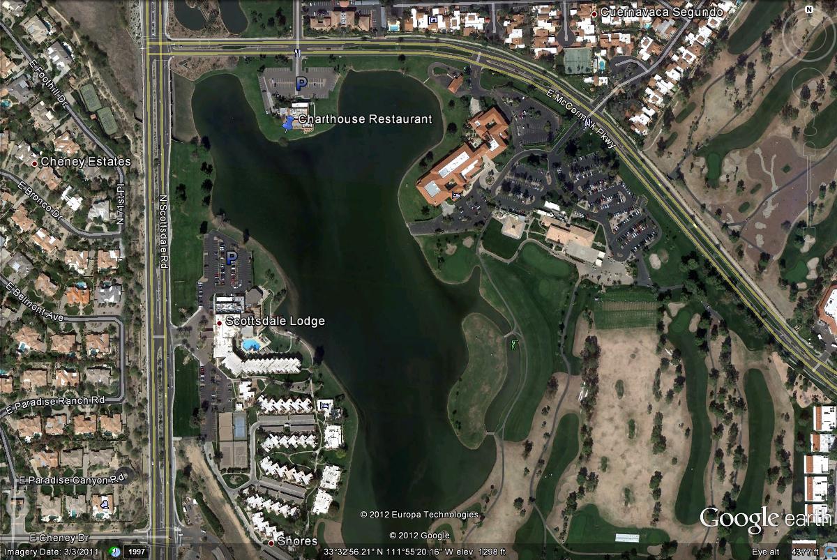
Map # 4: Scanning the lake from the Charthouse Restaurant.
After searching these ponds, from Indian Bend Road, head west until Scottsdale Road is reached. Head north on Scottsdale Road for about a mile until McCormick Parkway is reached. Turn right and head east on McCormick Parkway for a very short distance 0.1 miles where the parking lot to the Charthouse Restaurant will be on the south side of the road. Park here and scan the big lake for waterfowl. Scan only from the parking lot here, as it is private property. An additonal parking area to view this lake is south of the Charthouse Restaurant, and can be accessed along the east side of Scottsdale Road, 0.2 miles south of McCormick Parkway.
| 

