Forest Road 422/Pine Mountain Area Maps
*All maps property of Google.
Map # 1: Getting to Forest Road 422.
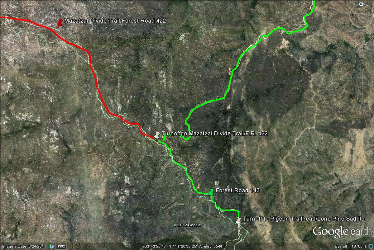
From the intersection of Shea Boulevard and the Beeline Highway, head north on Highway 87 (Beeline Highway) for 14 miles. Forest Road 422 (titled Mazatzal Divide Trail on some maps) is accessed from Forest Road 143, also known as the Four Peaks Road or the road to Four Peaks. The turnoff to Four Peaks is on the east side of Highway 87, between mile markers 203 and 204. Mile marker 204 is barely north of the Four Peaks turnoff. After turning, the road to Four Peaks is called Forest Road 143. Forest Road 143 runs for almost 18 miles until the turnoff to the Lone Pine Saddle is reached in the Transition Zone, that heads south. From here, head north for two to three miles until the turnoff to Forest Road 422 is reached. Turn west on Forest Road 422 (Mazatzal Divide Road) and head north to explore the area. An alternative route would be to take Forest Road 143 from Highway 188 for about ten miles until Forest Road 422 is reached. Coming up Forest Road 143 from Highway 188 through Gila County is much easier on vehicles than taking Forest Road 143 from Highway 87 through Maricopa County.

Map # 2: Accessing Forest Road 422 "Mazatzal Divide Trail/Road"
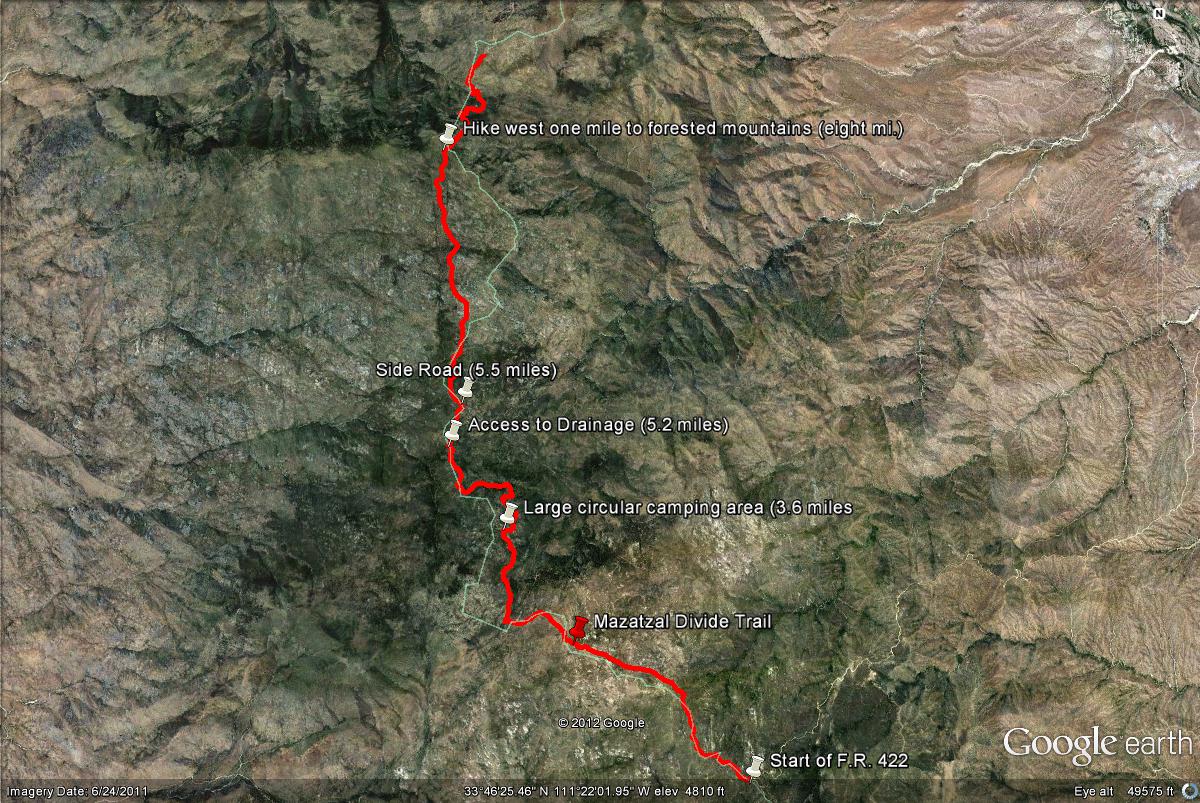
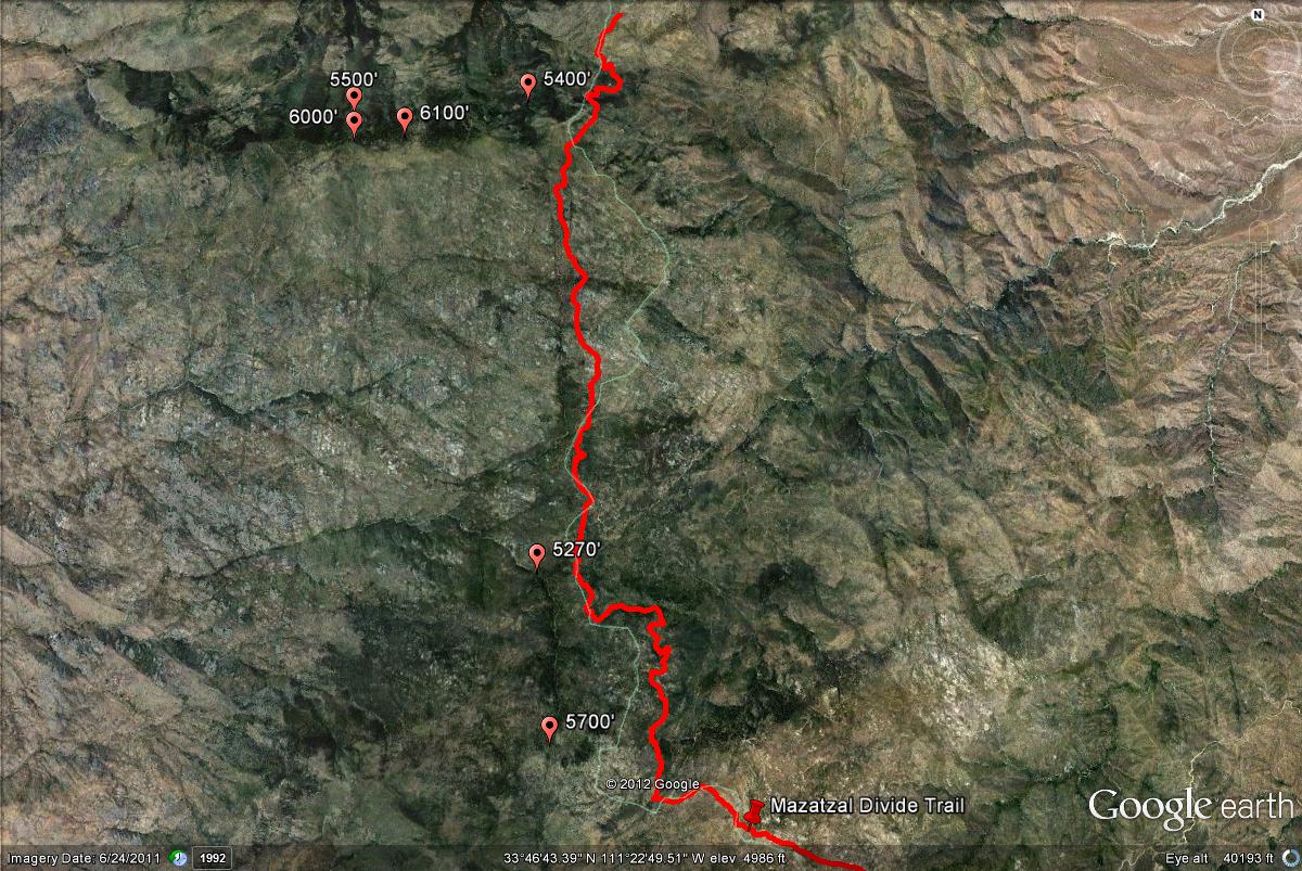
Map # 3: Overview of the Forest Road 422 and mile points.
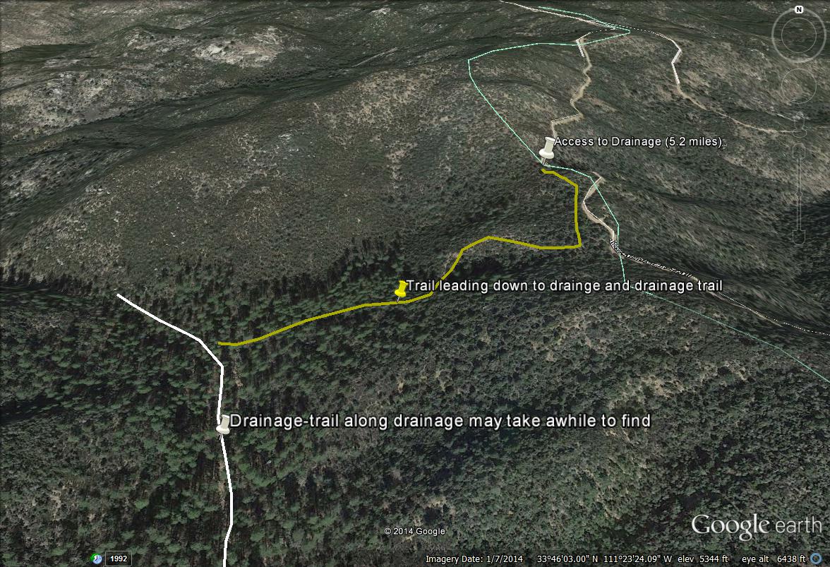
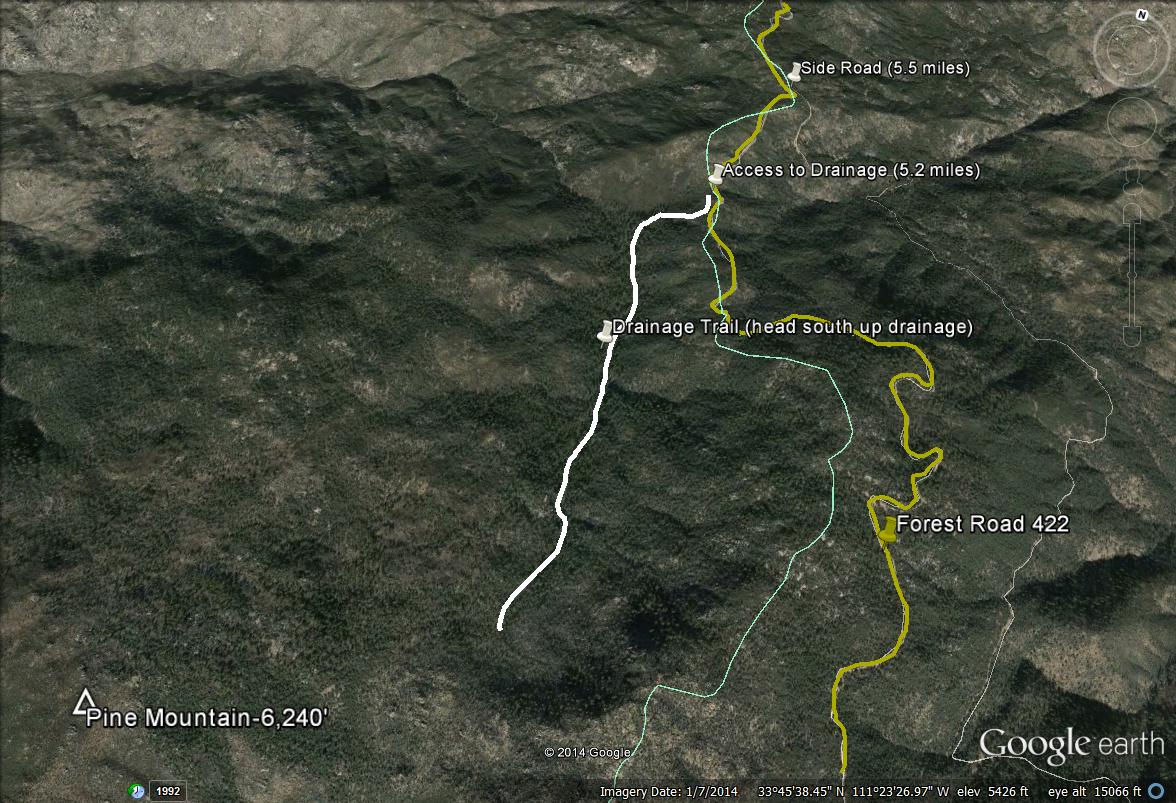
Once turning on Forest Road 422 "Mazatzal Divide Trail", good forest habitat begins at about three miles along the road. At about 5.2 miles, look for a fence opening on the west side of F.R. 422 (there are some areas with fences along the route). There is a trail that leads down into the forested drainage up in the direction of Pine Mountain. Follow this trail down into the area of the drainage, which is easy to follow. The habitat surrounding the trail is thick before the drainage is reached, one marking their path every 50 feet is a good idea to prevent searching for the trail in the dense habitat. One will be led down into a stand of tall pines from the start of this trail. Go west through the pines on the trail (which isn't distinctively marked) a short distance to the drainage, which is very easy to follow. If one has trouble finding this trail, a good marker is that there is a noticeable side road that branches off from the 422 just north of the trail opening. This road goes in the southeast direction in Gila County for a good distance and is not recommended for driving. After exploring or passing this 5 mile mark on the 422, continue north to explore more of the Mazatzal Divide, including the other forested mountainside west of the road at about 8 miles.
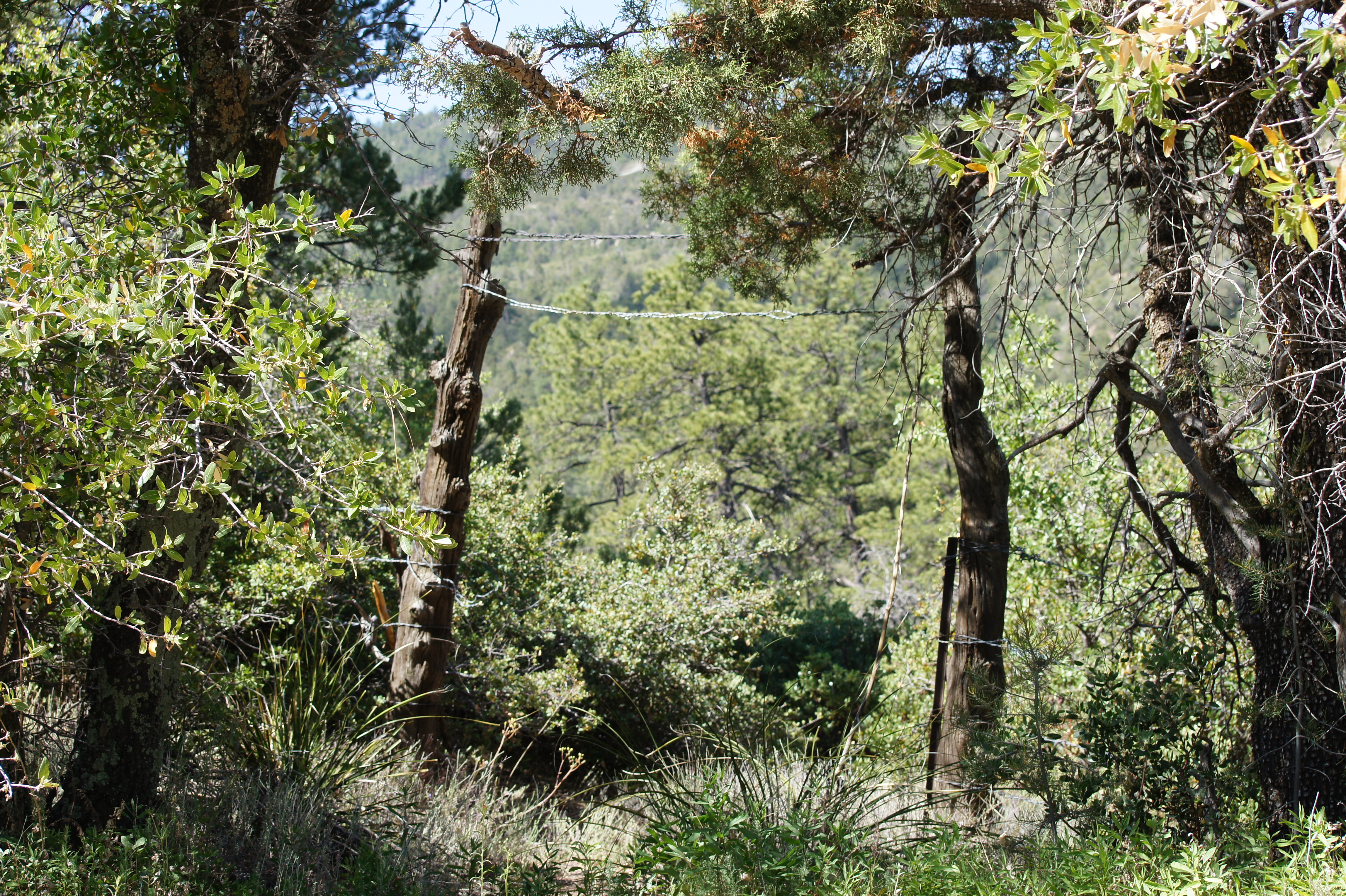
Here is a photo of the fence opening to access the trail that leads down to the drainage.
Map # 4: A closer look at accessing the drainage near Pine Mountain.
Map # 5: Overview of the Pine Mountian Area
Map # 6: Great forested areas along Forest Road 422 "Mazatzal Divide Trail" that are in Maricopa County.
| 

