Lower Camp Creek Maps
*All maps property of Google.
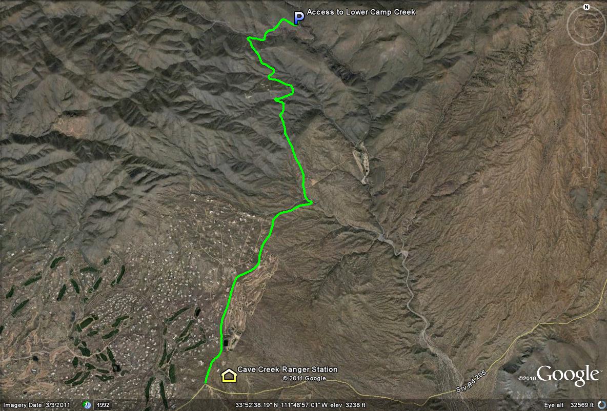
Map # 1: Route to Lower Camp Creek
From the east side of the loop 101, take the Pima Exit and then Pima Road north for 12 miles until the intersection of Pima and Cave Creek Roads meet. Then take Cave Creek Road east for four miles until the road turns into Seven Springs Road. It becomes Seven Springs Road after the turnoff to the Cave Creek Ranger Station. Once it becomes Seven Springs Road, head north for 5.5 miles (after a short distance it becomes all dirt road) to the access point of Lower Camp Creek, which well be between mile markers 5 and 6 on the road. The turnoff will be on the east side of Seven Springs Road where a gated fence prevents vehicle access. Park your vehicle in this parking area and walk past the fence and into the canyon, which is known as Rackensack Canyon. See the maps of this location under the "Pages" section of this page.
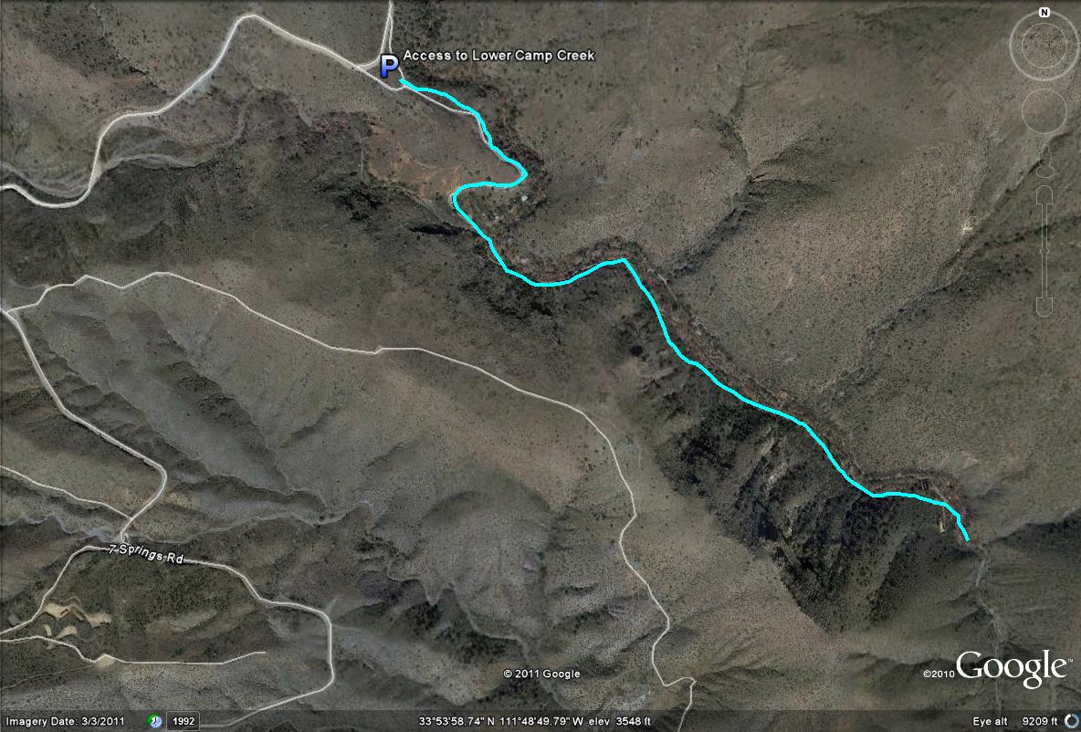
Map # 2: A closer look at the Lower Camp Creek overview
After parking, the light blue line shows the road that can be walked down into the riparian canyon with the cabins, which is an excellent birding stretch.
| 

