Mount Ord location maps
*all maps property of Google
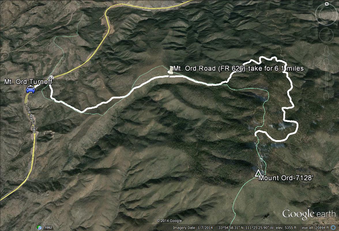
Map # 1: Complete Overview of Mount Ord Area.
This map shows a complete overview of the Mount Ord area. After turning east off of the Beeline Highway (Highway 87) at the Mt. Ord turnoff just north of mile marker 222, this road travels up from 4000' to 7000' for 6.1 miles and ends near the summit of Mount Ord. This is a dirt road in good shape overall, with several rough patches. Most passenger cars can even handle this dirt road. There are many places to get out and bird en route to the ending point at 6.1 miles. At the ending point is a parking area, where one has the option to hike for 3/4 mile up to the summit of Mount Ord.
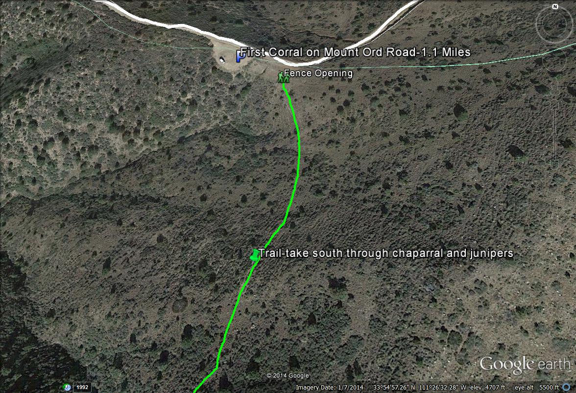
Map # 2. Birding Mount Ord's lower slopes and the first corral.
Mount Ord has habitat during the first three miles of the road that consist of the Upper Sonoran Life Zone with chaparral and juniper being the habitat makeup. This stretch crosses over the Maricopa and Gila County lines several times. After 1.1 miles of driving on the road east of the Highway 87 turnoff, one will come up on a corral on the south side of the road. Park here and walk through a fence opening on the east side of the corral. There is a hiking path that travels to the south. This trail is excellent for viewing Gray Vireo and Black-chinned Sparrow, and other chaparral and juniper species. The light blue line on the map above the start of the green path is the Gila/Maricopa County line, with Gila being north of the line.
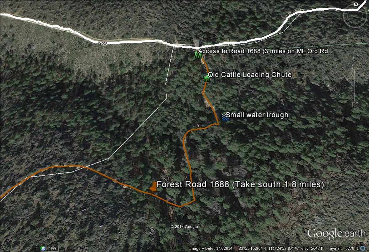
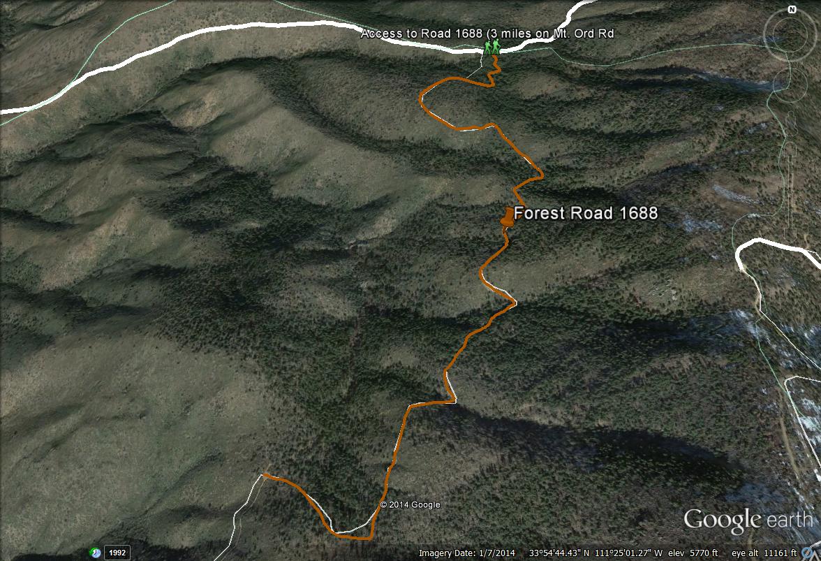
Map # 3: Accessing Road 1688.
Road 1688 is popular among birders due to it's close distance to the Highway 87 turnoff and quick access to tall ponderosa pine forest. It is also completely in Maricopa County for it's entire duration, being the one road in Maricopa County high country where county lines aren't ever an issue. Road 1688 is three miles from the start of Mount Ord Road after turning off of Highway 87, and it is on the south side of the road. It is easily found as the road comes into contact with stands of pine trees. There are noticeable places to park by the start of 1688. Forest Road 1688 travels for 1.8 miles south through ponderosa pine/oak forest as well as chaparral and juniper habitats. It is a great place to see a variety of birds. Features of the beginning stretch of this road include an old cattle loading chute and a small water trough.
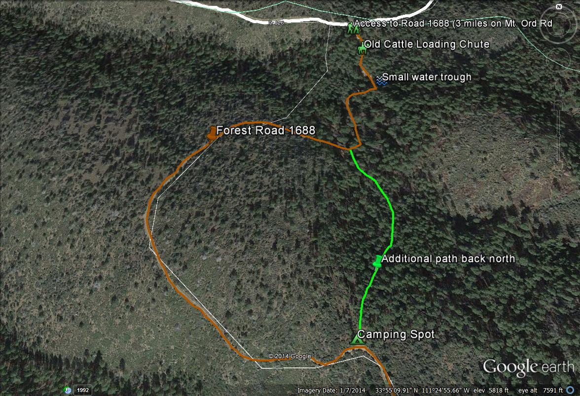
Map # 4: A quick loop hike near the beginning stretch of Road 1688.
If one is wanting to do a quicker hike on Road 1688 without hiking it to the end, there is a possible loop hike one might want to do. After passing through the first stand of pines, one will venture back out to the western direction and will come out into chaparral and juniper habitat. The road will curve back to the east again and there will be a stand of ponderosa pine on the north side of 1688, which is part of the first big stand. There is an old camping area here. Walk north and down through the pines, which follows a path. This path will take one back to the water trough and back down to 1688, completing a nice little "loop" through a good habitat variety.
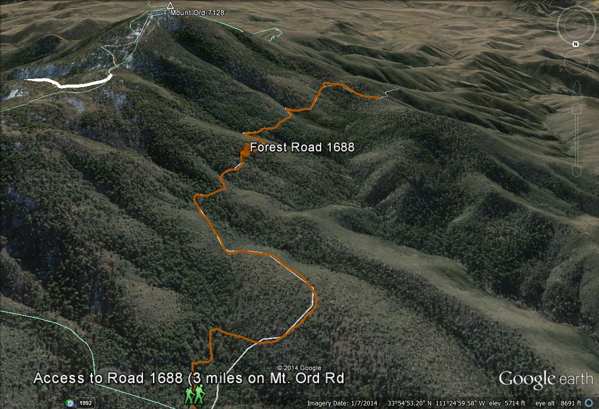
Maps 5 and 6: Overviews of Road 1688.
Two maps are included for overviews of Forest Road 1688. As mentioned above, Road 1688 travels for 1.8 miles south through great habitat, and it is all completely in Maricopa County. The top map will show views facing north and the bottom map shows views facing south. The bottom map with the views of 1688 facing south also shows good views of Mount Ord's western slopes as well as the summit. These western slopes are all completely in Maricopa County also. The elevation of Forest Road 1688 is roughly 6000' throughout most of it's duration.
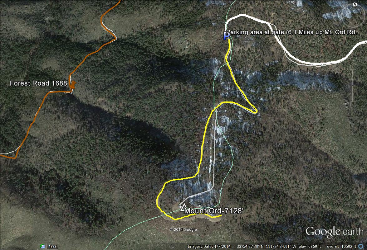
Map # 7: Accessing the Summit of Mount Ord.
After 6.1 miles of driving on Mount Ord Road towards Mount Ord from Highway 87, the road comes to a dead end. There is a gated area which prevents further vehicular access. One is allowed to hike past this point towards the summit of Mount Ord for 3/4's of a mile (indicated on this map by a yellow line path). This area is open from 9 A.M. through 6 P.M. While hiking up in this area, Maricopa County is reached after passing the sign that indicates, "Mound Ord Lookout-1/2 mile away). In the upper slopes of Ord near the parking area, some of the road area is in Maricopa County too, including the parking lot. Refer to maps for exact locations.
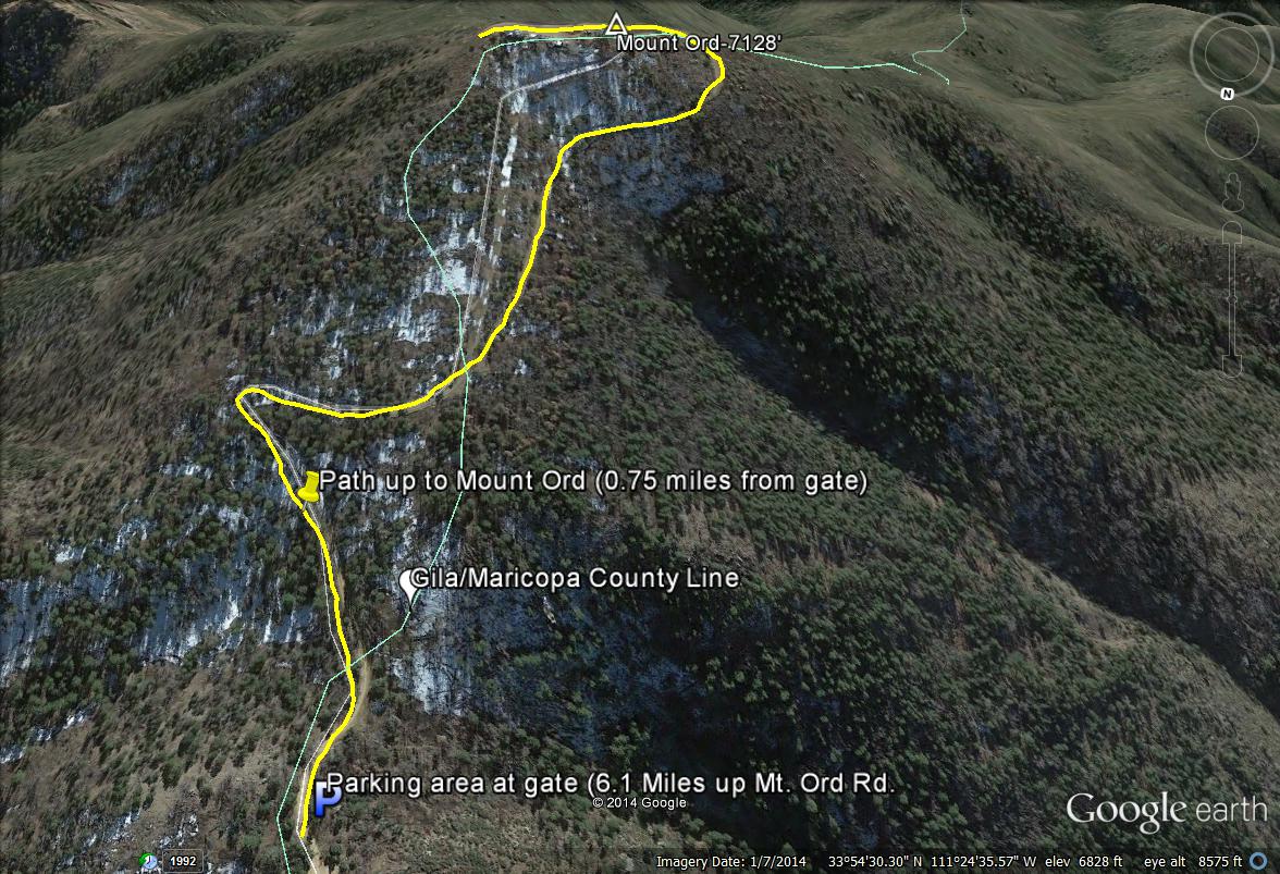
Map # 8: Another view of the summit area from Mount Ord while facing south.
This map shows the summit area of Ord if facing south. Points that are illustrated are the path to the summit, the Gila/Maricopa County line, the parking area, and the summit of Mount Ord. Maricopa County is on the right side of the line, which is west.
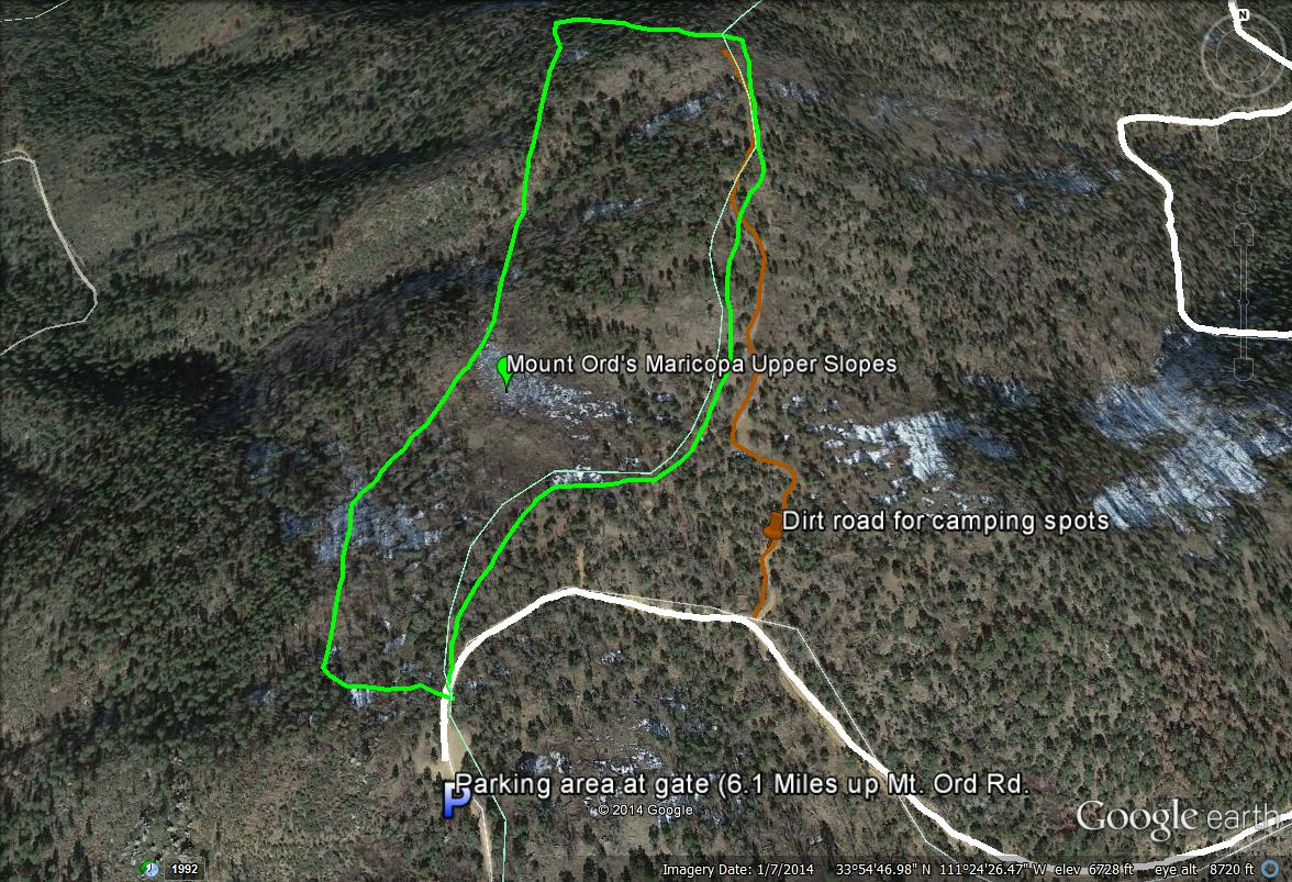
Map # 9: Birding Mount Ord's upper western slopes in Maricopa County.
If parking at the end of the road near the gate or by following a dirt road (hiking is more recommended, it's a rough road) shortly northeast of the gate through camping areas (accessed from the north side of Mt. Ord Road), one can bird Mount Ord's higher and western facing slopes. These slopes are rather steep, but one can easily bird them without going down too far. There is a good stretch of habitat to bird along, and the stands of pine and oak here are excellent for finding Transition Zone species. On the map, refer to the area between the light green border, which is easily accessed from Mount Ord Road (ivory-white path) and the dirt road leading through camping spots (brown path). Forest Road 1688 can be seen on the western border of this map, which is 800 feet lower than these upper slopes.
| 

