Mesquite Wash Maps
*all maps property of Google
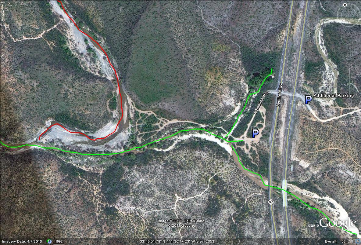
Map # 1-General overview of Mesquite Wash
P-Best parking area for Mesquite Wash
P-Additional Parking: For times when road work is being done and road construction does not permit left-hand turns. Park near the trailhead that is on the east side of Highway 87, and walk across the highway to access the area.
Lime-green lines: General birding area of Mesquite Wash, with the best paths and habitat being west of the Highway 87. Good but less riparian habitat lies east of the Highway.
Red lines: Is where Sycamore Creek runs into Mesquite Wash. By following Sycamore Creek northwest past this point as the red lines show, good birding oppurtunities shall present themselves along this stretch also.
| 

