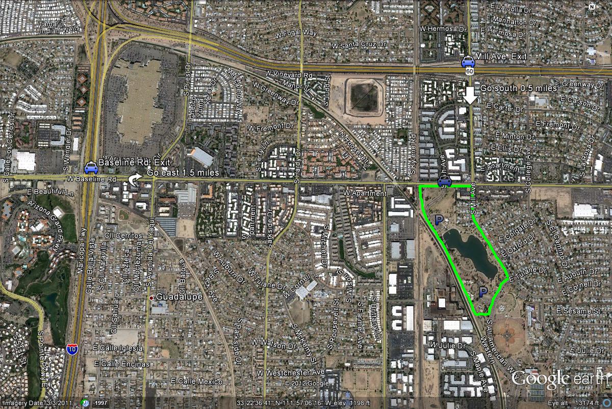
Kawanis Park is surrounded by several freeways, making it easy and quick to access. One route to get to the park is by taking the I-10 (Maricopa Freeway) to the Baseline Road exit. Once on Baseline Road, head east for 1.5 miles to the turnoff to Kawanis Park, which will be on the south side of Baseline Road. Another conveniant way to reach the park is closeby on the U.S. 60 (Superstition Freeway). Take the Mill Avenue exit south for 0.5 miles when on the U.S. 60 to Baseline Road. Head west shortly on Baseline Road for 0.1 miles to the Encanto Park turnoff on the south side of Baseline Road. These are directions to access the north and main parking lot of Encanto Park. If wanting to access the south parking lot, continue south on Mill Avenue past Baseline Road for 0.5 miles to All American Way. Take All American Way a very short distance west (left turn) to the south side and parking area of the park.