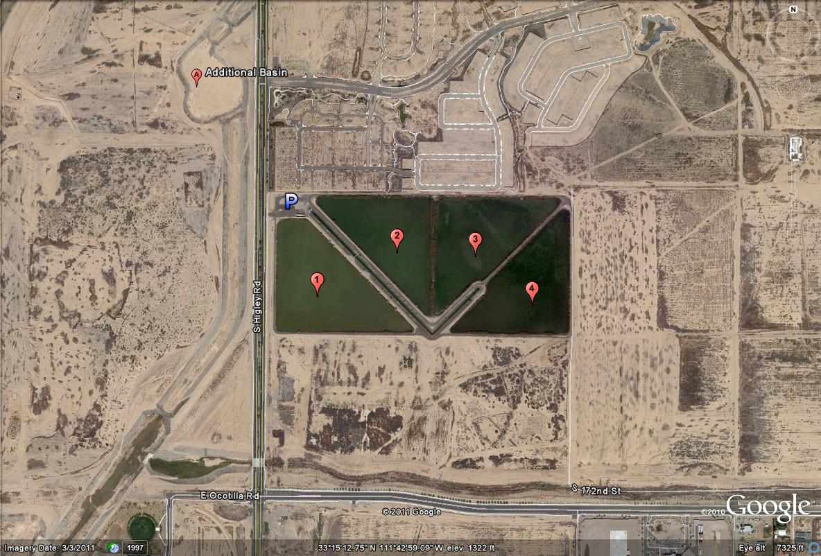
This map shows the general overview of the Higley Road Ponds. They are located on the east side of Higley Road. To the north of the parking lot on the west side of Higley Road, lies an additional basin, which sometimes has water in it. This additional basin has had shorebirds in it at times.
These ponds can be reached by taking the Higley Road exit on the 202 (Santan Freeway) by heading south for five miles. The main crossroads bordering Higley that the ponds are in between are Queen Creek Road to the north and Chandler Heights Road to the south. From taking the US 60 Highway south at the Higley exit, it is just over nine miles, making the Higley Ponds also eight miles south of Gilbert Water Ranch, which Higley Road is just east of the ranch.