Highway 188-Jakes Corner to Tonto Basin
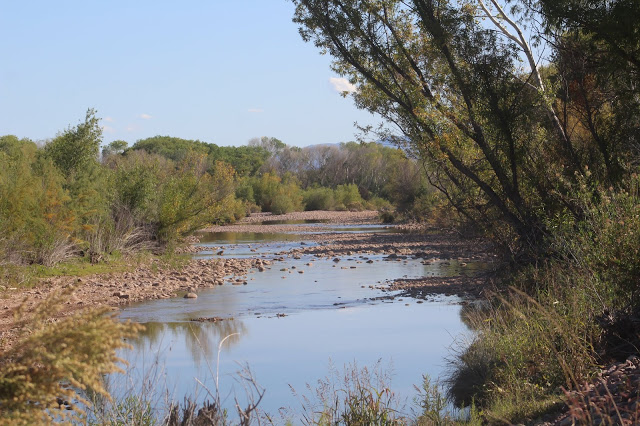
The birding locations in this area feature some of the best riparian areas in Gila County at access points along Rye Creek and Tonto Creek. Cottonwood and willow riparian forests line these creeks, and these riparian areas have great potential for finding many birds. Upper Sonoran desert surrounds most of this area, and in some of the higher elevations in the area, such as Rye Creek, there is a mix of Upper Sonoran, chaparral, and juniper woodland.
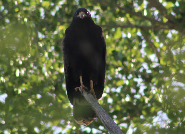
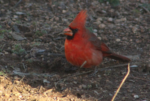
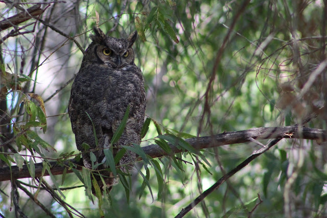
In this area, breeding birds that can be found within the riparian habitats and their immediate desert surroundings include Gambel's Quail, White-winged and Mourning Doves, Greater Roadrunner, Yellow-billed Cuckoo, Black-chinned and Anna's Hummingbirds, Cooper's Hawk, Common Black-Hawk, Great Horned and Western Screech-Owls, Gila and Ladder-backed Woodpeckers, Gilded Flicker, Willow Flycatcher, Black Phoebe, Vermilion Flycatcher, Brown-crested Flycather, Cassin's Kingbird, Bell's Vireo, Verdin, Black-tailed Gnatcatcher, Cactus Wren, Curve-billed and Crissal Thrashers, Phainopepla, Lesser Goldfinch, Black-throated Sparrow, Song Sparrow, Abert's Towhee, Yellow-breasted Chat, Hooded and Bullock's Orioles, Bronzed Cowbird, Lucy's and Yellow Warblers, Common Yellowthroat, Summer Tanager, Northern Cardinal, and Blue Grosbeak. In mixes of upper Sonoran desert, chaparral, and juniper woodland, species one can encounter will include Ash-throated Flycatcher, Woodhouse's Scrub-Jay, Juniper Titmouse, Bewick's Wren, Canyon Towhee, Rufous-crowned Sparrow, and Scott's Oriole. Spring and fall migrations will be a major birding highlight with a lot of diversity throughout this area, and winter will have surprises as well.
Directions: For directions, the base point of this area will be Jakes Corner. Use the mileages from Jakes Corner for travel on Highway 188 whether you are driving north or south on the highway. To get to Jakes Corner from Fountain Hills, at the Shea Boulevard and Highway 87 intersection head north on Highway 87 for 49 miles to Highway 188. Take Highway 188 east for 3.3 miles to Jakes Corner. From Payson, head south on Highway 87 for 15.8 miles to Highway 188, and then head east on Highway 188 for the 3.3 miles to Jakes Corner. Finally, from Globe, start from the south side of Highway 188 and take it north for 57.6 miles to Jakes Corner.
BIRDING LOCATIONS
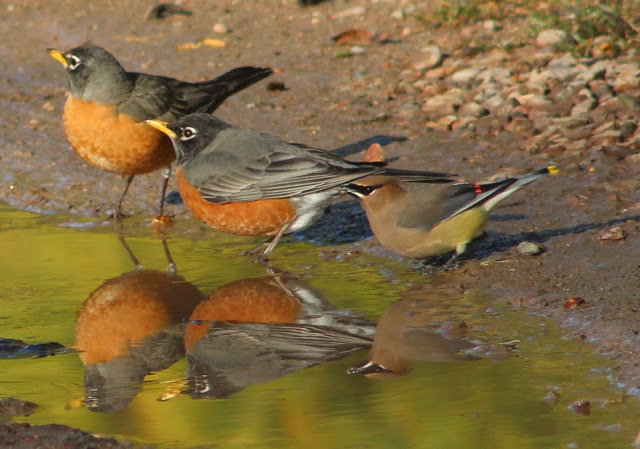
-Jakes Corner: Jakes Corner (see directions above) is a census-designated place that has a bar, gas station and general store, and a trailer park. The trailer park and riparian habitat behind the store have had good birding at times. Rufous-backed Robin has been found before.
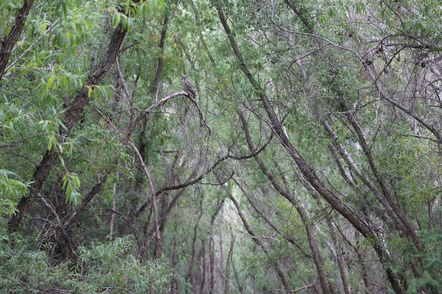
-Rye Creek via Forest Road 184: On the north side of Highway 188 and directly across the street from the Jakes Corner bar and general store is FR 184. From here, follow FR 184 north for 3.2 miles just past a steel bridge that goes over a canyon that harbors Rye Creek, and ends at a pull off that turns sharply to the left and south direction. Follow this pull off barely south to access a parking area. From the parking area, the pull off remains as a short road and it goes down toward Rye Creek. Once down at the creek, there are thick stands of cottonwood and willow along the creek for about a mile in both directions. There are also stands of mesquite and hackberry in midst of the riparian forest, as well as an upper sonoran desert setting with a few saguaro cactus, juniper, and chaparral on the surrounding slopes and route on FR 184 toward Rye Creek. Rye Creek has great potential for a variety of birds during migration. To get the most out of the area, bring an old pair of shoes to walk down the creek in places. It is almost impossible to bird the creek accurately without crossing it. The most effective birding route would be to follow the creek to the southeast from the parking lot for about a mile until private property is reached. There is also private property about a mile along Rye Creek to the north of the parking area-be sure to respect the property if birding here. Head further north up FR 184 to access the community of Gisela and it's stretch of riparian habitat along Tonto Creek (this will be in the Highway 87 Area-from Mt. Ord to the southern Payson limit).

-Farm Pond along Highway 188: From Jakes Corner, head east and south for 4.3 miles on Highway 188. On the east (left) side of Highway 188 look for a small pull off. Pull off here and look just to the northeast where there is a farm pond. This pond has times when it is full, half-full, or more-often-than-not, empty. When there is water in the pond, it attracts numbers of waterbirds and it is always worth a check when birding in this area or en route to the Roosevelt Lake area.
-Punkin Center, Greenback Crossing RV Park, and Tonto Creek via Greenback Crossing Road (aka FR 71): From Jakes Corner, take Highway 188 east and south for 10.7 miles. Turn east (left) on the paved road at 10.7 miles that goes toward Punkin Center. This road is labeled as FR 71 on maps, and follow it for a short distance just past the fire station and make sharp right turn. The roads in this small community have a variety of different trees that may attract interesting birds throughout the year. Continuing past the sharp right turn, quickly look for a dense patch of trees on the right (south) side of the road that are worth birding in throughout the year, especially during migration. Just past this point is the Greenback Crossing RV Park. The park has tall trees in midst of it's RV parking lines and it attracts a lot of birds, especially during the winter months and would hold potential for rarer thrushes like Rufous-backed Robin and Eastern Bluebird. Just east of the RV park is a riparian and desert area near Tonto Creek and it is also good for birding. Continuing just east on Greenback Crossing Road past the RV Park, the road crosses Tonto Creek. Park just off the road here or nearby to explore the cottonwood and willow riparian stands of Tonto Creek. The best habitat here is on the south side of Greenback Crossing Road, where one can explore for a considerable distance. From the sharp right turn at the entrance to Punkin Center to the point of where Greenback Crossing Road crosses Tonto Creek, the distance traveled along is only about a half-mile.
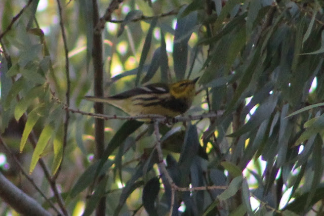
-Tonto Creek via Bar X Crossing Road: From Jakes Corner, take Highway 188 east and south for 14.2 miles to Bar X Crossing Road. Head east on Bar X for about a half mile to Tonto Creek, where one can park on either side of the creek. At times of the year, Tonto Creek has flooding and crossing the road is extremely dangerous. If the water level has to be questioned for crossing with a vehicle, DO NOT cross the road. Birding wise, this stretch of Tonto Creek harbors what is one of the very best lowland riparian areas in Gila County. The area is massive and there is a lot of ground to cover and explore. Besides the amount of ground that can be explored here, the stands of willow and cottonwood forest can be hard to access due to piles, stacks, and clumbs of wood. Entering the woodlands and birding them accurately will require a lot of bushwhacking. If bushwhacking is not of any desire, the outskirts of the riparian forest can be very effective too. This area can almost be divided into four quadrants from a birding approach. The western side of the creek on the north side of Bar X Road is one, the western side of the creek on the south side of Bar X Road one is two, the eastern side of the creek on the north side of Bar X Road is three, and the eastern side of the creek on the south side Bar X Road is four. Out of the four, the latter southeast quadrant is on average the most effective. While all times of the year will have high bird numbers in a habitat like this, the migration periods have the highest potential for great bird diversity and discovering a vagrant. Notable birds that have been found here so far have included Black-throated Green Warbler, Broad-billed Hummingbird, American Redstart, Dickcissel, and Yellow-bellied Sapsucker. Gray Hawk can be found sometimes in spring and summer. Habitat surrouding the riparian forests are mesquite woodland and upper Sonoran desert.
-Sleepy Hollow RV Park: From Jakes Corner, take Highway 188 east and south for 14.6 miles (just past Bar X Crossing Road) to Sleepy Hollow Way. Head east on Sleepy Hollow Way for 0.2 miles toward Sleepy Hollow RV Park. Find a place to park on the side of the road and explore the tall mesquite trees and a high variety of planted and native trees within the area of the park. This location harbors great potential for finding unusual birds in migration and winter. Eastern Bluebird has been found here before.
-Tonto Creek via A Cross Road: From Jakes Corner, take Highway 188 east and south for 17.4 miles to A Cross Road. Head east on A Cross Road for a mile, crossing Tonto Creek and park at a parking area just east of the creek, either on the north or south side of A Cross Road. This is another outstanding riparian area and stretch of Tonto Creek, and this location is only a few miles north of Roosevelt Lake. Tonto Creek can be followed in both the north and south directions from A Cross Road. The habitat make up is like it is along Tonto Creek via Bar X Crossing Road, but the riparian woodland here is thinner and more concentrated and is without the bushwhacking majority factor. Migrants will be easier to find here due to the habitat being more confined and not as spread out in every direction. Northern Waterthrush and Dickcissel have been found here before.
Back to Gila County Birding Areas |


