Highway 180/191 (Sipe Wildlife Area to Forest Road 56)
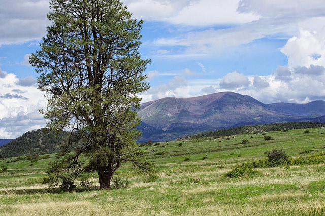
Driving south on 180/191 past Springerville and Eager towards Alpine brings in several excellent birding locations. The Sipe White Mountain Wildlife Area is found here, and it is one of the best birding locations in the White Mountains. With it's pleasant mix of habitats and trails, one is bound to have a great birding outing. Nelson and Nutrioso Reservoirs give one a chance to see a variety of waterbirds while Forest Road 56 accesses higher elevations in the region with spruce-fir and aspen forests. The 10,877' Escudilla Mountain is also accessed from Forest Road 56, and it is Arizona's third highest peak. Pinyon Jay, Dusky Grouse, American Three-toed Woodpecker, Mountain Bluebird, Osprey, and Montezuma Quail are a few of the many birds people may find in this neat area.
Getting to this area: From the main Highway 260 traffic light in Eagar, head east on 260 towards Alpine. This road quickly turns into Highway 180/191. After 5 miles of driving southeast, this area begins at the turnoff to the Sipe White Mountain Wildlife Area. Vise versa, if one was coming from the south, then Alpine would be the closest town to this area. From Alpine, go north on Highway 191/180 for close to 6 miles to the Forest Road 56 turnoff just north of mile marker 421 on the east side of the Highway. For other areas mentioned on here, proceed further north for their designated mileages that will be given on this page under location descriptions.
Overview Map: To get an overall visual idea of where the placements of each birding location is within this area, click on the link here- Highway 180/191 (Sipe to FR 56) Overview Map
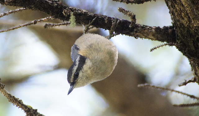
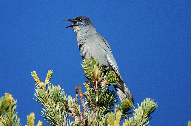
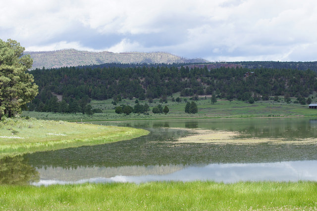
Sipe White Mountain Wildlife Area: To get to Sipe White Mountain Wildlife Area, follow Highway 260 directly east from Eager for five miles towards Alpine. Highway 260 will quickly turn into Highway 180/191 after the route starts. At five miles of following Eagar on 260 and then on 180/191, the turnoff for Sipe Wildlife Area will be on the south side of 180/191 at mile marker 404.7. From here, a graded dirt road that is usually in good condition is followed for five miles to the Sipe Wildlife Area. This location doesn't require any fees. Sipe is one of the best birding locations in the White Mountains and it is always filled with a variety of birdlife due to the many habitats it has to offer. Habitats here include orchards near the visitor center, creekside riparian, a few ponds, a few small reservoirs, grasslands, rocky bluffs, pinyon-juniper woodlands, and ponderosa pine forest. Over five miles of trails go through this pleasant wildlife area. The Wallow Fire touched the upper forested ridges that tower over the wildlife area, but most of Sipe remains beautiful. The north side of Escudilla Mountain can be seen well wherever one is at Sipe. Summer is the most popular time for birding in this area, but Sipe holds great potential throughout the year, especially in migration. During summer, hundreds of migrating hummingbirds can be seen coming to feed at the many feeders that are hosted near the Visitor Center. Broad-tailed and Rufous Hummingbirds are abundant, and keep an eye out for uncommon Calliope and Black-chinned Hummingbirds. There are hummingbird banding events at this location, which brings in crowds of people at times during the summer. Sipe is probably the best place in the White Mountains to view Pinyon Jays. If coming earlier in the morning, one may see multiple flocks of these gregarious corvids. Flocks of over 100 have been recorded here, and it is quite fun to watch. Many common birds can be observed here that favor grassland and forested habitats within the White Mountains region. Most outings at Sipe will result in 40 or more species being recorded in only a few hours. In migrations and winter, unusual birds will probably show up at this location. Grasshopper Sparrow and Yellow-bellied Sapsucker are two rarer species that have been found in fall migration. The three reservoirs in this area: McKay, Trinity, and Glen Livet, are worth checking for waterfowl and shorebirds. McKay is the largest reservoir of the three and holds the most potential. There are four hiking trails in Sipe Wildlife Area: the Rudd Creek Loop Trail (3 miles), the High Point Loop Trail (about 1 mile), the Homestead Trail (about 1 mile, accessed from the Rudd Creek Loop Trail), and the Trinity Trail (probably about a half mile). Out of these four trails, the Rudd Creek Loop Trail is the best for birding. It goes through all of the different habitats that are found at Sipe Wildlife Area and it parallels Rudd Creek for a good duration. Throughout Sipe, birds one will see in the summer months may include Gadwall, Cinnamon Teal, Montezuma Quail (with a lot of luck), Osprey, Red-tailed Hawk, Sora, Spotted Sandpiper, Greater Roadrunner, Lewis's Woodpecker, Red-naped Sapsucker, Hairy Woodpecker, Western Wood-Pewee, Dusky and Cordilleran Flycatchers, Western Scrub-Jay, Clark's Nutcracker, five species of Swallows, Mountain Chickadee, White-breasted and Pygmy Nuthatches, Rock and Canyon Wrens, Western and Mountain Bluebirds, Townsend's Solitaire, Green-tailed, Spotted, and Canyon Towhees; Chipping, Vesper, and Lark Sparrows; Western Tanager, Black-headed and Blue Grosbeaks, Lazuli Bunting, Eastern and Western Meadowlarks, Bullock's Oriole, and Pine Siskin. Sipe is open from sunrise to sunset and has nice restrooms. Visitor Center hours are open from 8 a.m. to 5 p.m. For more information on Sipe Wildlife Area, a separate page is available with pictures of Sipe and some of the birds that have been seen at Sipe, an eBird link to Sipe Wildlife Area, and a few maps of this area. To access that page, click on the link here- Sipe White Mountain Wildlife Area
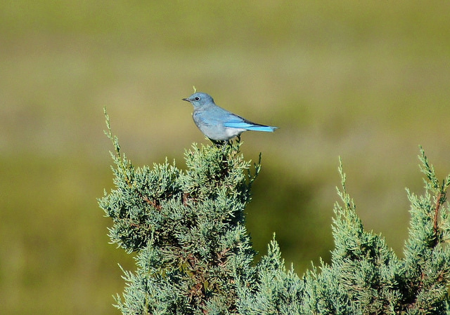
Nelson Reservoir: From the Eager stoplight on Highway 260, head east towards Alpine (as mentioned above) on 260 which will quickly turn into Highway 180/191. After nine miles of driving, the north side of Nelson Reservoir can be accessed on the west side of 180/191 where there is a parking area and restrooms. There is another parking area at the south side of this lake that is another mile further south on the west side of the highway. Nelson Reservoir is a good birding location, and there is a trail that runs along the western side of the lake. To access it, go on the northwest side of the lake and cross the dam to find the trail. The elevation of Nelson Reservoir is roughly around 7,400' and the habitat makeup of the area includes open water, riparian and marsh, pinyon pine and juniper woodlands, and rocky bluffs. Nelson Reservoir parallels Highway 180/191, and the noise created from the highway makes it harder to hear birds at times. Other than the highway noise, this lake is a pleasant place for birding. If accessing the trail on the west side of the lake, it goes along the lake and also goes through pinyon pine and juniper woodland. This is another great location for viewing Pinyon Jays. By walking up slope from the trail through the woodlands a good distance, not only is the highway noise reduced, but rocky bluffs are accessed. This is also said to be a good location for finding Montezuma Quail (Stuart Healy). Ospreys use this lake heavily during the summer and multiple birds are often present at one time. Other birds to look for in late spring and summer months include Ruddy Duck, Pied-billed Grebe, Double-creasted Cormorant, Black-crowned Night-Heron, White-throated Swift, Ash-throated Flycatcher, Rock and Canyon Wrens, Townsend's Solitaire, Black-throated Gray Warbler, Spotted and Canyon Towhees, Hepatic Tanager, and Yellow-headed Blackbird. In migrations and winter, look for a variety of waterfowl and other waterbirds such as grebes, loons, gulls, and terns. Among a few unusual birds that have been seen here was a Least Tern in 2014 (Babs Buck). For a separate page with more information on Nelson Reservoir that contains bird and scene photos, an eBird link to Nelson Reservoir, and maps of the location, it is available at the link here- Nelson Reservoir
Nutrioso Reservoir: After 17.2 miles of driving on Highway 180/191 from Eagar, the turnoff for Nutrioso Reservoir is accessed on the west side of 180/191 at Auger Canyon Road (County Road 2269). This is just south of the first turnoff to the town of Nutrioso, which is on the east side of Highway 180/191. Turn right (west) onto Auger Canyon Road and then after that turn, make another quick right turn to access the edges of the lake. Scanning this lake has to be done from the road because it is on private property. A variety of waterfowl and other waterbirds have been recorded here throughout different seasons. The road along the lake sits along ponderosa pine forest, so a lot of the usual forest birds are seen and heard as well. This is a location that is easy to check on and it shouldn't take a lot of time unless there are abundant bird numbers on the water. A few rare birds that have been found here have been Tundra Swan and Eurasian Wigeon (Eric Hough). To access a separate page on Nutrioso Reservoir that contains location photographs, a link to the hotspot page for the lake on eBird, and an area map, click on the link here- Nutrioso Reservoir
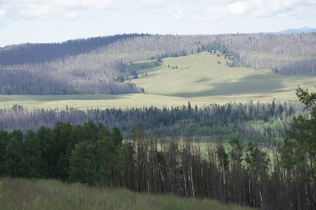
Escudilla Mountain and Terry Flat Loop (Forest Road 56): After driving 20.8 miles on Highway 180/191 from the Eagar stoplight, look for Forest Road 56 on the east (left) side of the highway. This turnoff is just north of mile marker 421 on the 180/191. On the other hand, this turnoff is only about six miles if coming north on 180/191 from Alpine. Forest Road 56 is a dirt road in decent shape and it accesses Hulsey Lake, Terry Flat, and Escudilla Mountain. This road runs for 5 miles before it comes into contact with the six-mile Terry Flat Loop and the trailhead for the Escudilla Trail # 308. Forest Road 56 is a pleasant drive with beautiful mixed conifer, aspen, and spruce-fir forest habitats. Stopping at any pulloffs along the road should result in a productive birding stop. At two miles, Road 56 turns off to the small Hulsey Lake. Hulsey Lake was undergoing construction recently and because of that, it wasn't covered for this write up yet. Once the construction is finished, the lake will hopefully return to it's former status. Mixed conifer and aspen surround the lake. Continuing up Forest Road 56 one comes into contact with Terry Flat and the Escudilla Trail. Forest Road 56 goes around Terry Flat in a loop and continues past the Escudilla Trailhead and loops around to the main course of Road 56 before the Escudilla Trailhead. The loop is about six miles in length, and as mentioned before, this loop is for high clearance vehicles only. Once past the Escudilla Trailhead, the road conditions decrease heavily as well as the other turnoff before the Trailhead. Sadly, this area was hit hard by the 2011 Wallow Fire, but it is still a beautiful place despite the burn. The Escudilla Trail # 308 climbs for three miles to the 10,877' Escudilla Mountain, which is the 3rd highest point in Arizona. This trail goes through a huge stand of aspen for the first mile of the trail, and it also goes through open meadows and spruce-fir forests. The upper elevations of the mountan were charred by the fire, but the views are still spectacular. There is also a lookout tower that climbs to higher views at the peak. Among the forest birds in the area, keep an eye out for Dusky Grouse and American Three-toed Woodpecker. The Terry Flat loop has open meadows as well as aspen and spruce-fir forests. Keep an eye out for high elevation forest birds including Northern Goshawk, Three-toed Woodpecker, Williamson's and Red-naped Sapsuckers, Olive-sided Flycatcher, Warbling Vireo, Red-breasted Nuthatch, Golden-crowned Kinglet, Townsend's Solitaire, Red Crossbill, and Pine Siskin. For a separate page on these locations that include pictures of the scenes and birds, eBird links, and location maps, that page is available at the link here- Escudilla Mountain and Terry Flat Loop (Forest Road 56)
Back to White Mountain Birding Areas |


