Greer Birding Hotspot Overview Map
*Map property of Google Earth
This map's purpose is to show the birder a high overview of the main birding hotspots in Greer. Each number corresponds to the specific Greer birding hotspot, which will be listed below the map. Some hotspots are roads, and numbers are repeaded twice or more for a few hotspots. This is to show how much of the area a few of these hotspots cover.
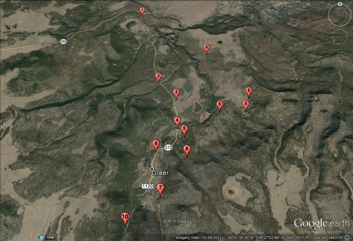
1. Lang Creek
2. Benny and Rosey Creeks
3. Greer Lakes
4. Little Colorado River (north-most crossing from Highway 373)
5. County Road 1126
6. North County Road 1126
7. East Fork Road and East Fork of the Little Colorado River
8. Butler Canyon Nature Trail
9. Osborne Road and West Fork Trail No. 94
10. West Fork of the Little Colorado River and Government Springs Trail
Back to Greer Recreation Area | 

