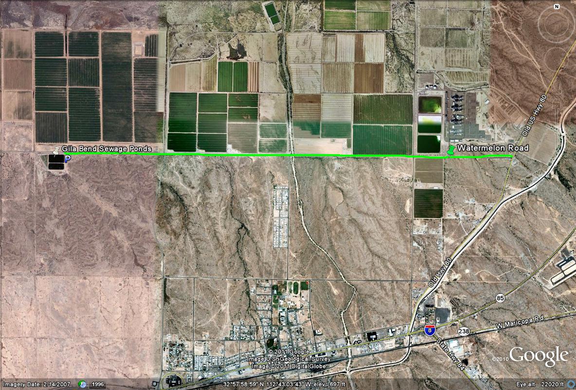
To access the Gila Bend Sewage Ponds, drive west on Watermelon Road for 3.6 miles after turning onto Watermelon Road from the Old Highway 80 (which Watermelon is accesed about 1.7 miles from the very south end of the Old Highway 80 where the I-8 is located, between mile markers 1 and 2). While on Watermelon Road, pay attention to the roadside mileage signs, which the Sewage Ponds will be located between mile markers 3 and 4. Once to the sewage ponds, they will be on the south side of Watermelon Road on an obviously elevated surface and turnoff as well. On the east side of the ponds, there is a road/pulloff one is allowed to drive on, but no tresspassing is allowed past the gated fence. However, perfect views are provided from standing on this road just east of the ponds. One will pass by the Gila Bend Wastewater Treatment Plant along the way also, so both of these Gila Bend locations are very close to each other.