"Foxtail/Sheeps Crossing stretch" Maps
*All maps property of Google
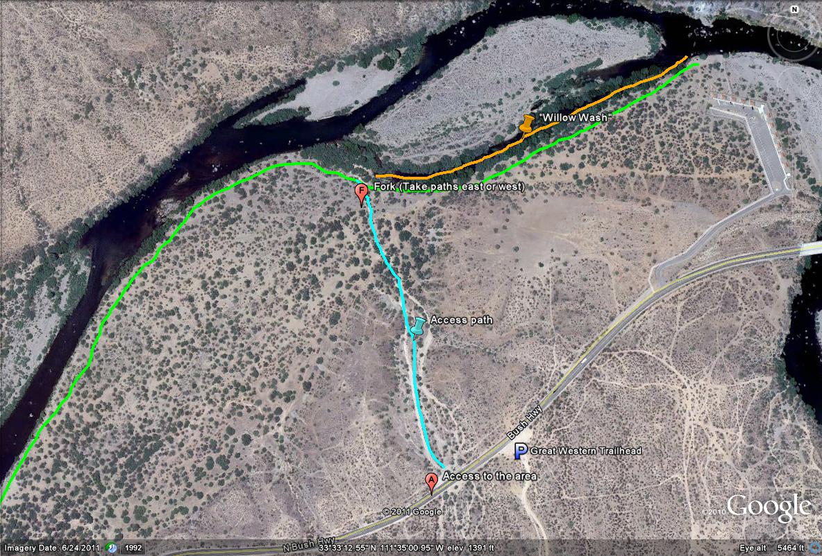
Map #1: Access to the Foxtail/Sheeps Crossing stretch
Since the official Foxtail and Sheeps Crossing Sites have closed access, this alternative access area turns out to have much better habitat diversity and birding, making a winning situation. To access this other place, park at the Great Western Trail's trailhead, and just west of that trailhead on the north side of the road is a closed road to vehicles. Walk into that area by going under the gate and explore the area.
Key-
Light blue line/path: Access to the Foxtail/Sheeps Crossing Area. There is excellent mesquite habitat along this stretch.
Light Green line/path: General birding along the river (follow the Salt River and trails west 1.3 miles to reach the official Foxtail Recreation Site), both west and east along the access path.
Orange line/path: "Willow Wash". An excellent wash full of willows, 0.4 miles in length, destined to a be great spot to check for goodies during migration. It almost runs right into the Sheeps Crossing Recreation Site (parking lot just southeast of the wash)
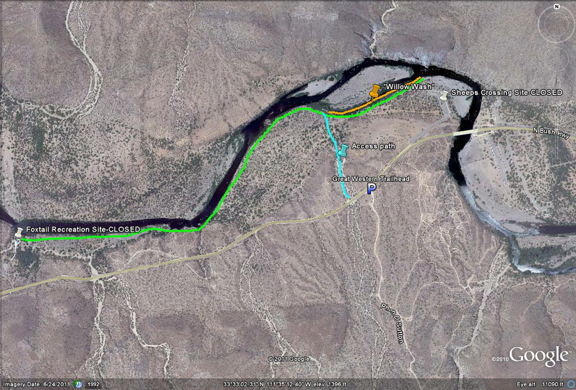
Map # 2: Overview of the Foxtail/Sheeps Crossing Area:
NOTE: If wanting closer access to the Foxtail Recreation Site, there are several pulloffs along the Bush Highway that are much closer to that spot, but would require fence hopping. The alternative route to the area by taking the access point across from the Great Western Trail will likely result in better birding oppurtunities with a better mix of habitat.
Sheeps Crossing and Foxtail Recreation sites are 1.7 miles in distance away from each other if wanting to complete the hike along this stretch.
| 

