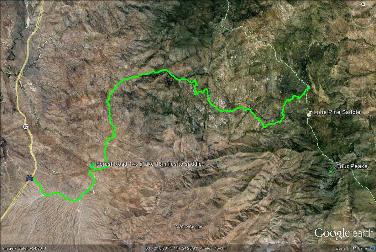
From the intersection of Shea Boulevard and the Beeline Highway, head north on Highway 87 (Beeline Highway) for 14 miles. The turnoff to Four Peaks is on the east side of Highway 87, between mile markers 203 and 204. Mile marker 204 is barely north of the Four Peaks turnoff. After turning, the road to Four Peaks is called Forest Road 143. Forest Road 143 runs for 18 miles until the turnoff to the Lone Pine Saddle is reached in the Transition Zone. Take the road south to Lone Pine Saddle for 1.5 miles at the intersection with Forest Road 143. Once at the parking at the end of this road, this is where one may access the ponderosa pine and oak habitats. For an additional route, Forest Road 143 continues for 11 miles east to Highway 188, which is lined by Roosevelt Lake. Getting to Lone Pine Saddle is much easier if coming from Highway 188 on Forest Road 143, which is much easier vehicles and a shorter distance. This is a good route to take if one wants to only bird in the Transition Zone.