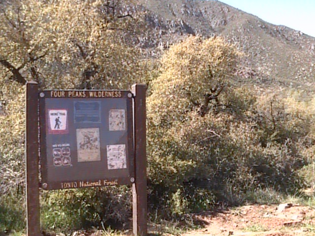
Four Peaks Wilderness
Fast Flight Facts
Target Species: An amazing combination of desert, riparian, chaparral, juniper, and ponderosa pine and oak species
Elevation: 1600'-7600'
Habitat: 20 mile route from Lower Sonoran to Transition Zones
Overall Birding Rating: 5
Difficulty: 1-5 (Easy through Very Difficult)
Birding Type: Easy to Difficult Hiking, Get Out and Scan, Car Birding
Facilities: None; Convenient pull offs for camping overnight
Fees/Ownership: No fees, part of the Tonto National Forest
Closest Town or City/How far from Phoenix: Fountain Hills/ 36 miles northeast of Phoenix (turnoff to 143)
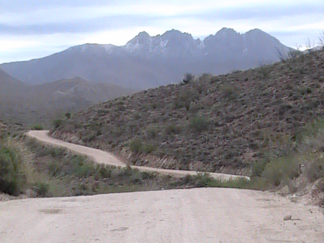
Getting there: The area is accessed from Highway 87 on a very rough dirt road, Forest Road 143, which passes through different life zones on a 20 mile route
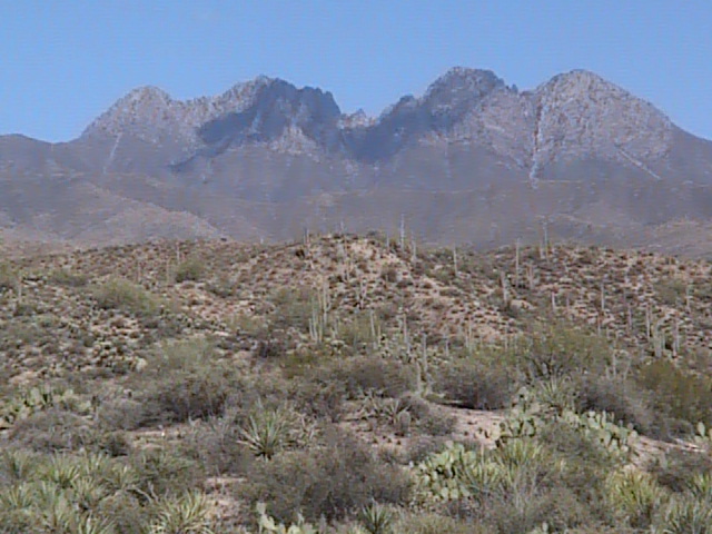
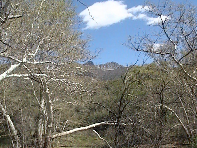
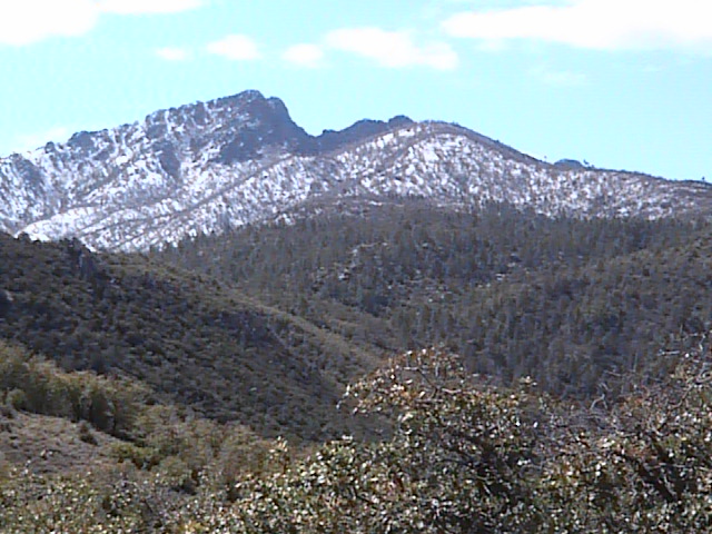
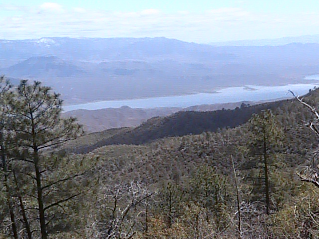
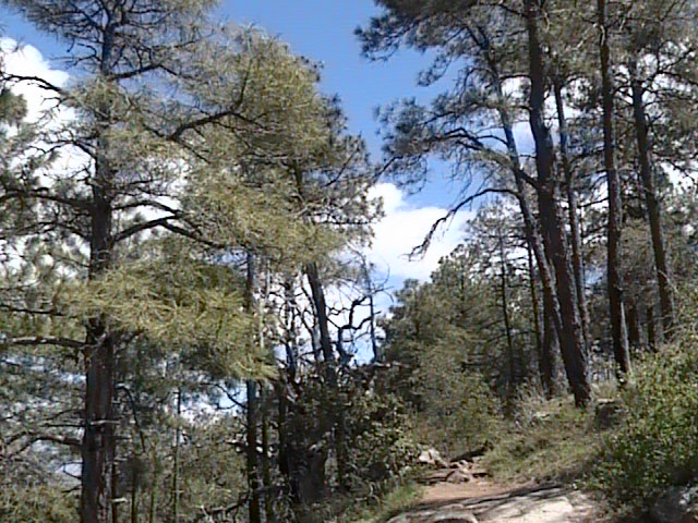
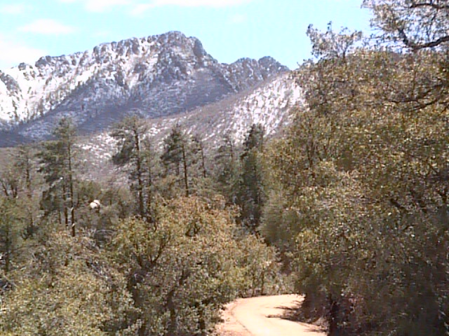
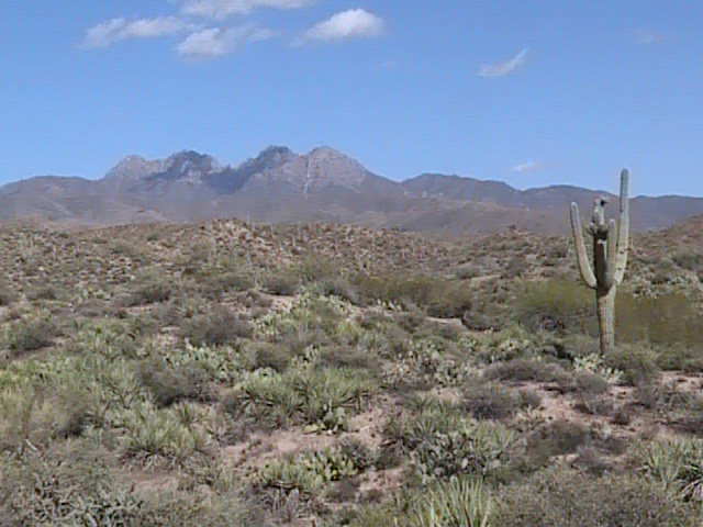
Overview: The summits of the Four Peaks overshadow their surroundings and can be seen from far distances and directions away. One of these peaks is the highest point in Maricopa County, which is the 7657' Brown's Peak. The Four Peaks are found in the southern end of the Mazatzal Mountain range, which is the mountain range that holds most of the "high country" in Maricopa County. Good ponderosa pine and oak forest habitat are found near the summit of Four Peaks, although a good portion of this Transition Zone habitat was burned out in a fire that surround the base of the summit. Regardless of the fire damage, good birding is still found in the areas that the fire missed. The main highlight of the Four Peaks Wilderness isn't just the area of the summit itself, but is the route that leads birders to the summit. This route is Forest Road 143, and is accessed from Highway 87. This rough, long, bumpy, and rocky dirt road starts off in the Lower Sonoran Zone under 2000' and continues on for twenty miles to the 6-7,000' Transition Zone. Great habitat is found along this stretch, where one may have a great day of birding with the different habitats and avian diversity. This road through the Four Peaks Wilderness is the only singular route in Maricopa County where one is given the opportunity to pass through the Lower Sonoran Zone and continue through a drastic change of habitats up to the Transition Zone. There are many exploring opportunities on the drive, where one needs to scan the different habitats regularly to see the wonderful variety of bird life and habitat.
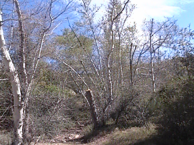
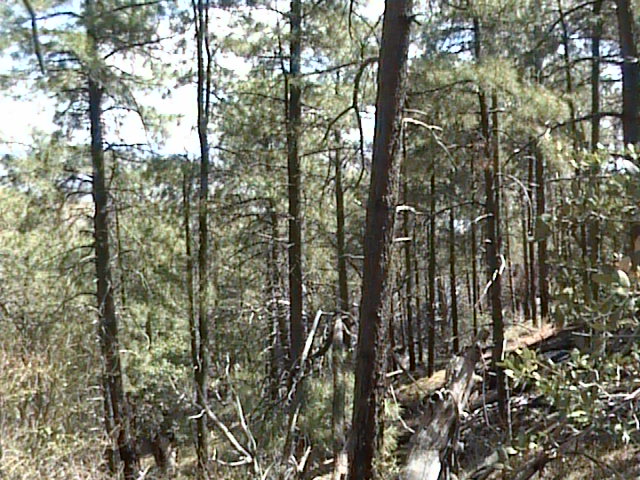
The Lower Sonoran Zone leads off a good portion of the first half of this route. Good birding can be found roadside when in this zone, or can be found throughout the drive by hiking through washes found in the area. Most of the regular desert species will be easy to find. Watch and listen for these species, which include: Gambel's Quail, Red-tailed Hawk, American Kestrel, Greater Roadrunner, Anna's and Costa's Hummingbirds, Gila and Ladder-backed Woodpeckers, Ash-throated Flycatcher (from here up to Transition Zone), Verdin, Cactus and Rock Wrens, Phainopepla, Lucy's Warbler, Black-throated Sparrow, Canyon Towhee, and Northern Cardinal. The Upper Sonoran Zone is gradually reached, and these habitats are passed for most of the second half of the drive. Excellent habitats are found in the Upper Sonoran Zone, consisting of juniper and pinyon-pine, chaparral, riparian, arid grassland, and some oak habitat. In juniper habitats, look and listen for Gray Vireos. Good habitat for the vireos is found throughout the zone, including several noticeable stands of juniper with some pinyon-pine. Also look for Western Scrub-Jay and Juniper Titmouse in this habitat. Scott's Orioles may be located in the surrounding slopes, especially those with agave. In areas with dense chaparral thickets, bird for Black-chinned Sparrows. There is plenty of favorable habitat for Black-chinned Sparrows, where one may turn up very good numbers. In the chaparral habitat, also keep Crissal Thrasher, Bushtit, Bewick's Wren, Rufous-crowned Sparrow, and Spotted Towhee in mind. In midst of these mentioned habitats, good riparian habitat is found throughout the area where creeks cross the road. Most of it lies in the Upper Sonoran Zone, although some is still found in the Lower Sonoran Zone. Some of these habitats consist of dense willow stands with some cottonwoods mixed in. A majority if the riparian habitat is made up of Arizona sycamores and walnut trees. These habitats are worth searching at any time of the year and will be excellent for breeding species, as well as migrants and wintering species. Some breeding examples found in these riparian habitats include Bell's Vireo, Yellow Warbler, and Hooded Oriole. The Transition Zone is finally reached after birding through extensive habitat in both the Lower and Upper Sonoran Zones. At Four Peaks, the Transition Zone mainly consists of ponderosa pine and Gambel's oak. Views of the surrounding area are amazing once reaching this point, which includes great overlooks of Roosevelt Lake to the east. Just like other Transition Zone habitats in Maricopa County, this area too is on the Maricopa and Gila County lines, which adds challenges to county listing. Forest birds complete the bird diversity of the Four Peaks Wilderness in the areas near the summit points of the peaks. A variety of forest species will be here throughout the year, but include Broad-tailed Hummingbird, Acorn Woodpecker, Northern Flicker, Plumbeous and Hutton's Vireos, White-breasted Nuthatch, and Olive, Grace's, Virginia's, and Black-throated Gray Warblers. Species in shrubby habitat that surround the forest habitat include Western Scrub-Jay, Bushtit, Bewick's Wren, Blue-gray Gnatcatcher and Spotted Towhee. From Upper Sonoran to Transition Zones, also look for Golden Eagles and Zone-tailed Hawks in the mountainous areas. With the amazing habitat and avian diversity in the Four Peaks Wilderness, this area will hold excellent birding at all times of the year. Be sure to explore this location!
Birding Tip: Four Peaks Wilderness is a very long and remote route to go on a birding expedition, be sure to not attempt this route alone and let someone know where you are going at all times. This is a popular area however, and may be crowded. The road is very rough for a lot of the twenty miles, come prepared. Although this road is rough, most vehicles can probably handle this route. Watch for other vehicles, especially when turning sharply around corners. For the best birding results, start early and visit all the different habitats mentioned above. Once in the Transition Zone, keep in mind that Maricopa and Gila County are constantly close to one another if county listing is a desire. Hiking here may be anywhere from simple to very difficult. There are also around 40 miles of hiking trails in the Four Peaks Wilderness. Be sure to obtain a map or trail guide for any further information on these trails.
Directions: From the intersection of Shea Boulevard and the Beeline Highway, head north on Highway 87 (Beeline Highway) for 14 miles. The turnoff to Four Peaks is on the east side of Highway 87, between mile markers 203 and 204. Mile marker 204 is barely north of the Four Peaks turnoff. After turning, the road to Four Peaks is called Forest Road 143. Forest Road 143 runs for 18 miles until the turnoff to the Lone Pine Saddle is reached in the Transition Zone. Take the road south to Lone Pine Saddle for 1.5 miles at the intersection with Forest Road 143. Once at the parking at the end of this road, this is where one may access the ponderosa pine and oak habitats. For an additional route, Forest Road 143 continues for 11 miles east to Highway 188, which is lined by Roosevelt Lake. Getting to Lone Pine Saddle is much easier if coming from Highway 188 on Forest Road 143, which is much easier vehicles and a shorter distance. This is a good route to take if one wants to only bird in the Transition Zone.
Pages:
Four Peaks Wildnerness Maps
Take Me There (Google Map)
Four Peaks Wilderness Area eBird Data
Scenes and Sights from Four Peaks Wilderness:
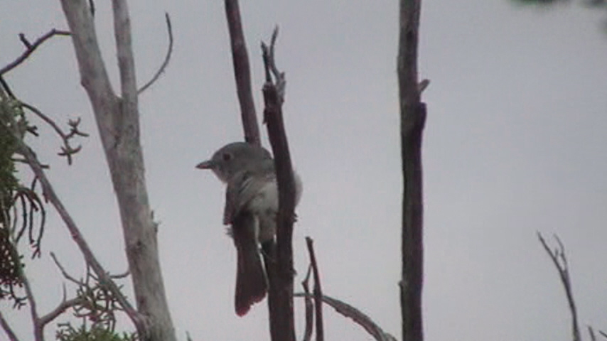
Bird Life of Four Peaks Wilderness:
Gray Vireo
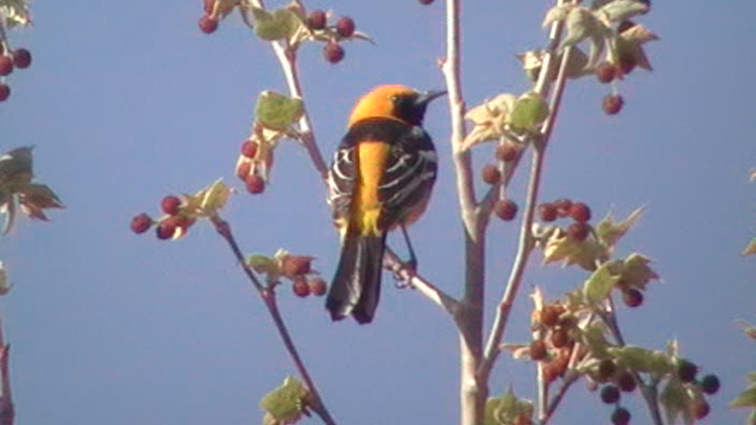
Hooded Oriole
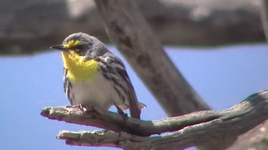
Grace's Warbler
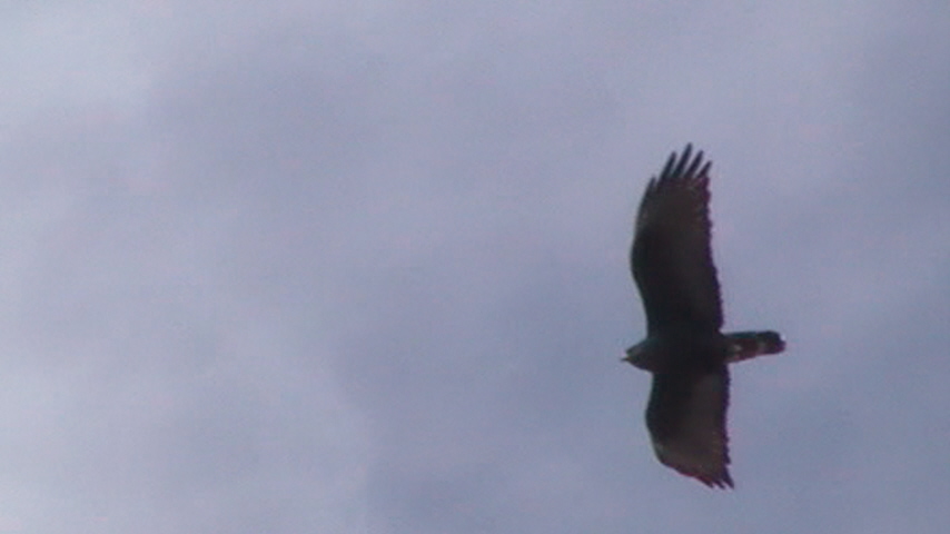
Zone-tailed Hawk
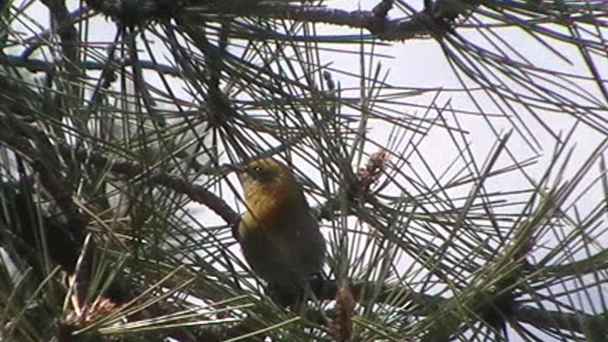
Olive Warbler
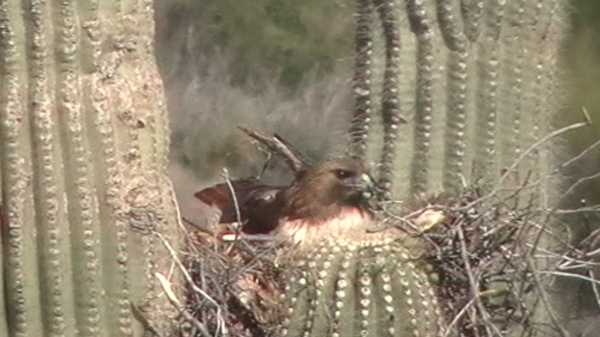
Red-tailed Hawk
Back to Area 1-Highway 87 from Desert to the High Country |


