Forest Road 25 Area Maps
*All maps property of Google.
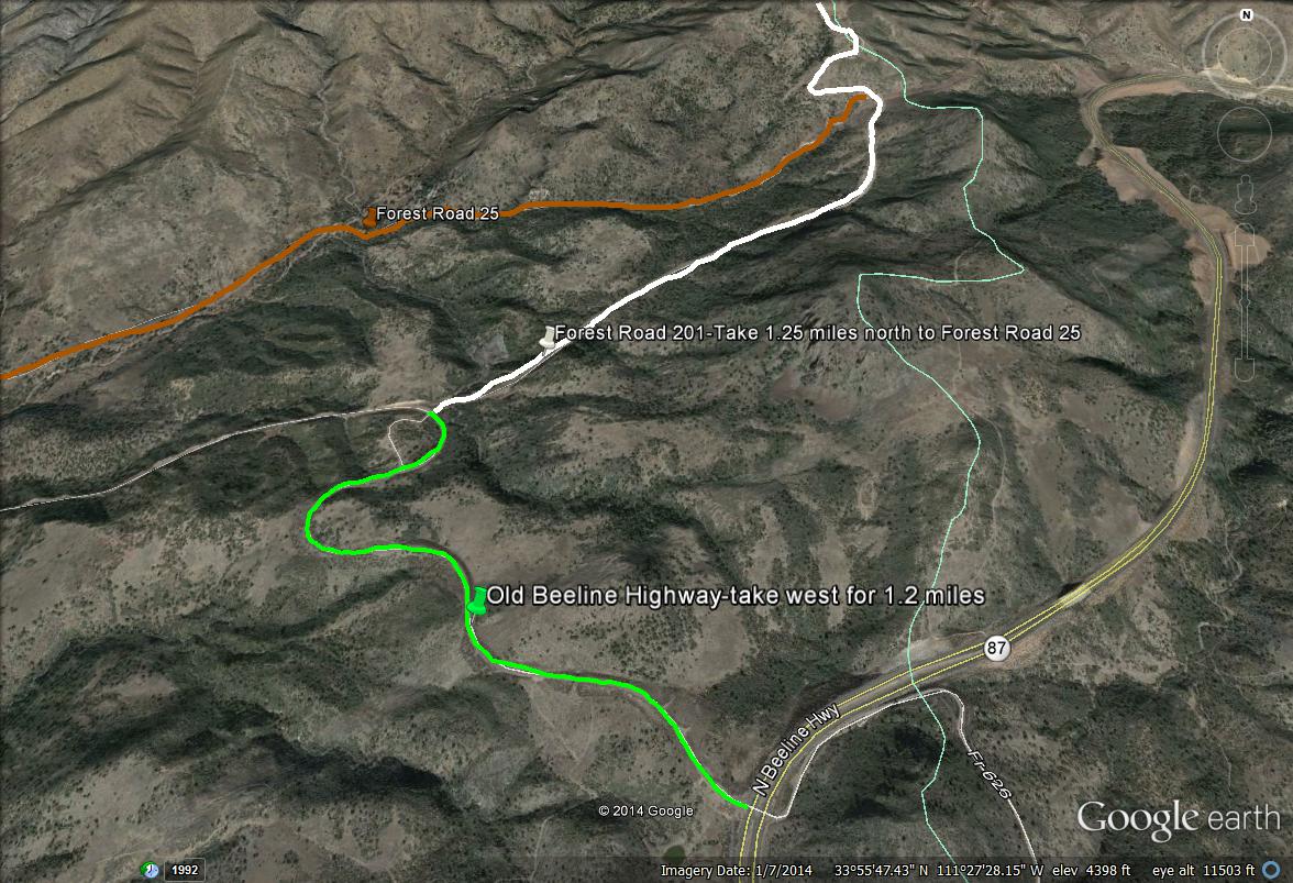
Map # 1: Getting to Forest Road 25.
The access point of this area is reached along Highway 87 (Beeline Highway) just north of milepoint 222, by taking the turnoff to Sycamore Creek to the west (adjacent to the Mount Ord turnoff to the east). This turnoff is about 35 miles north of where Shea Blvd. meets the Highway 87, as Shea Blvd. is a popular access point when taking the Beeline Highway anytime. Once turning on the Sycamore Creek turnoff, this is actually part of the Old Beeline Highway. After driving west for 1.2 miles on the Old Beeline Highway, you will come across a dirt road turnoff that goes in the northeast direction, which is Forest Road 201. Take Forest Road 201 for 1.25 miles to Forest Road 25 on the left (west) side of Forest Road 201. Head west on Forest Road 25 for 4.8 miles to it's ending limit.
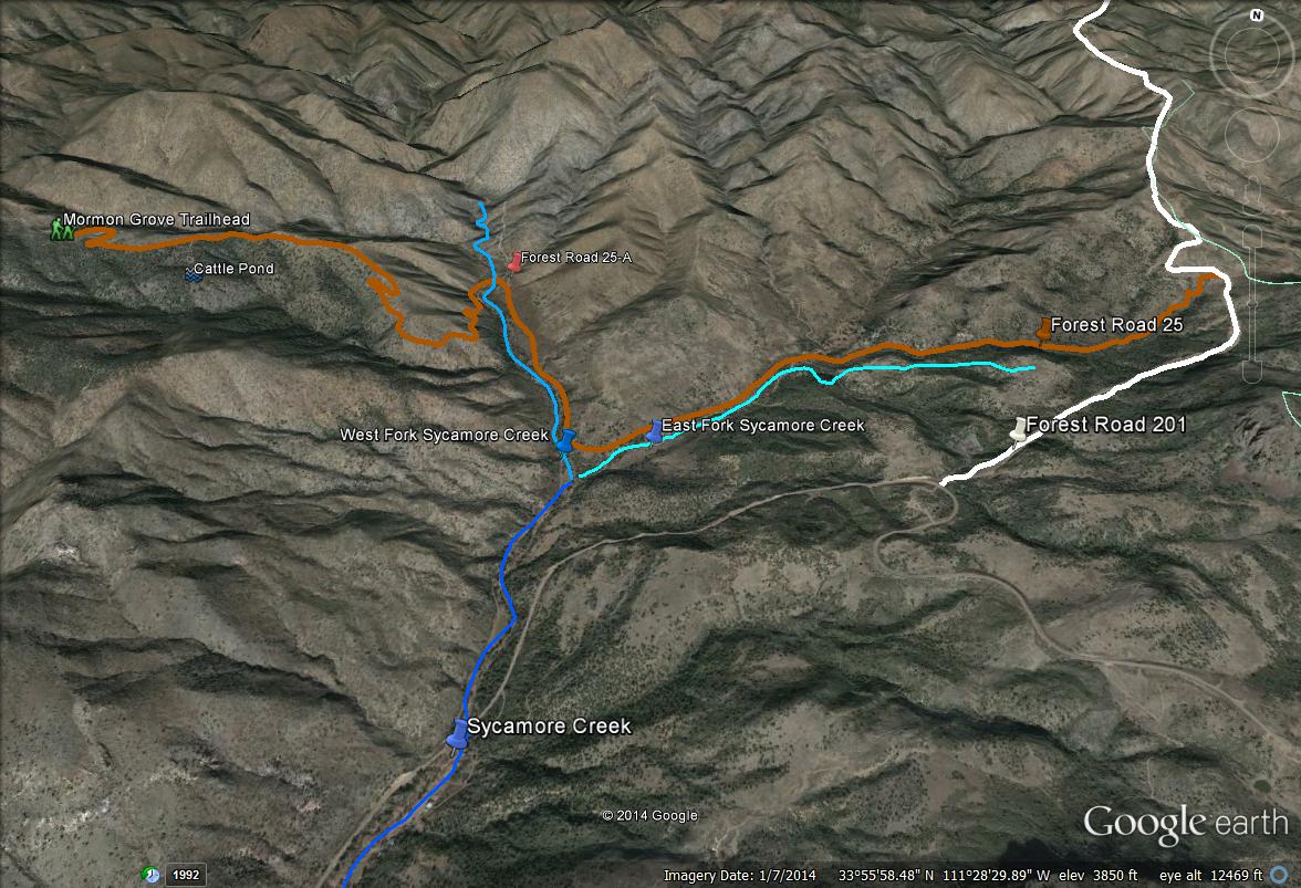
Map # 2: Plain overview of Forest Road 25

Map # 3: Points of Interest along Forest Road 25, as well as a detailed route explanation
This map shows a detailed illustration of what to expect along Forest Road 25, and these points of interest on this map will be explained. After turning west on Forest Road 25 from Forest Road 25, the route begins to go slightly downhill. One will soon be walking or driving adjacent to the East Fork of Sycamore Creek at this point. The road is in good condition along this beginning stretch. At two miles, one will reach the junction of Sycamore Creek, where it breaks off into the east and west forks. Road 25 will turn and head north, and the West Fork of Sycamore Creek will be adjacent to Road 25 along this shorter stretch of the road. Along this road, Sycamore Creek has water in it seasonally. At 2.6 miles, one will reach another road, signed Forest Road 25-A. This road heads north from here, and requires a very high clearance vehicle with a four wheel drive. A jeep or quad are suggested for this road, which goes for 6.1 miles and passes the old Sunflower Mine. Unless one is really eager to explore, ignore Forest Road 25-A, and continue in the western direction on Forest Road 25. Quickly after the turnoff for 25-A, Road 25 crosses the West Fork of Sycamore shortly after at 2.7 miles. Because of the 2012 Sunflower Fire, there have been many floods in this area, especially in Sycamore Creek. In the monsoon seasons, this crossing may be impassable. Use accurate precautions before driving across this crossing. When dry, it is completely easy to drive over. After this crossing at mile 2.7 and continuing up to mile 4, Forest Road 25 climbs upward with several steep and rough spots along the road. With this being said, it isn't any different than the road up to Mount Ord or Forest Road 201 up to Slate Creek Divide. At mile 4.3, keep an eye out for a trail/"road" heading south. Park nearby and walk down this trail for a quarter mile. This trail leads to a cattle pond. The pond may be a worthwhile visit early in the morning or later in the day for birds and other wildlife wanting a drink. Past this point, head west for a short distance to the ending spot of Forest Road 25, which is at the Mormon Grove Trailhead. The total distance of Forest Road 25 is met here at the Trailhead with a total of 4.8 miles.
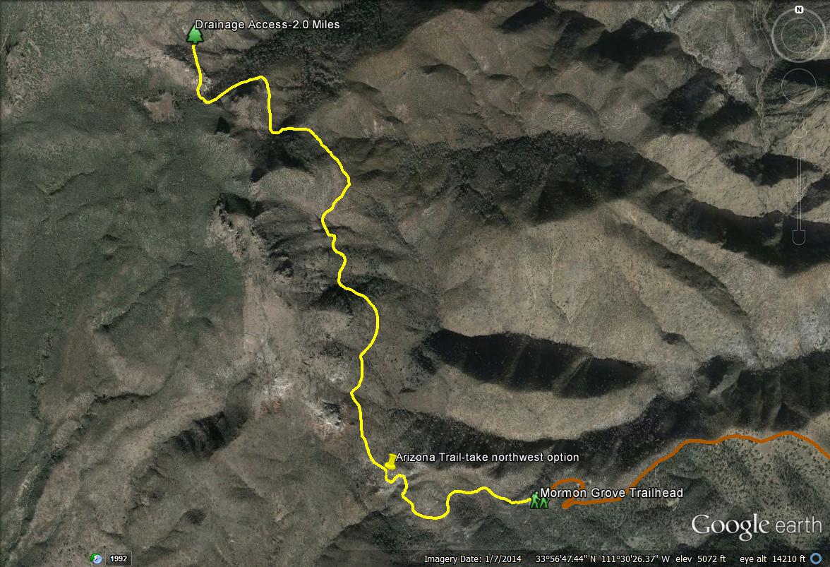
Map # 4: Hiking the Arizona Trail from the Mormon Grove Trailhead.
Other than birding and driving immediately along and adjacent to Forest Road 25, this area has a lot more of exploring involved. A great route to take would be to head north for a few miles along the Arizona Trail, which is accessed from the Mormon Grove Trailhead. Once hiking to the northwest on the trail from the Mormon Grove Trailhead, the Arizona Trail is accessed, and one may take the trail to the north or south. Head north for a few miles to get more of a habitat diversity. This trail climbs up gradually from 4900' at the Trailhead to 5400' at two miles. At two miles, one will start to see a north facing mountain that is covered with Douglas fir. One can't see the tall conifers well when walking along the trail to the south of the mountain until the trail loops around to the west and north side of the mountain. A drainage runs down through the duration of the mountain, which is noticeable along the trail. One may take the drainage/wash down into the Douglas fir forest, which also has plenty of oaks and alder trees. This drainage is very shady in places, and is beautiful. The length of the drainage walk is 0.7 miles, and goes from 5400' at the start by the trail to almost 5000' at the end of the Douglas fir. It is a challenging and bushwhacking rocky hike for the first half of the hike, and it is then very easy and pleasant during the second half of the walk. The Douglas fir forest on this mountain is in good shape despite being hit by the Sunflower Fire in several places. Overall, it seems to be a healthy stand of Douglas fir and it has the potential for interesting birds.
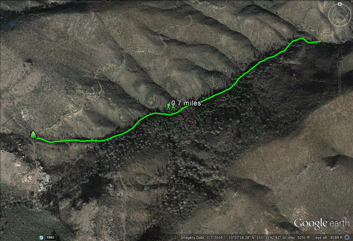
Map # 5: A closer overview of the Douglas fir drainage
The drainage is a pleasant and beautiful walk if proper safety precautions are thought of. It is best to walk down here with other people, do not come alone. There are many hazards here. Watch for loose rocks and slippery areas. Watch for rattlesnakes. Poison Ivy is also found in this area. If the drainage has pockets of water in it, there may be bees swarming around the water. Black Bears are also thick in this area: clap frequently to avoid surprising a bear. With this in mind, find neat birds and have fun!
|


