Estrella Mountain Lake Parks Maps
*All maps owned by Google.
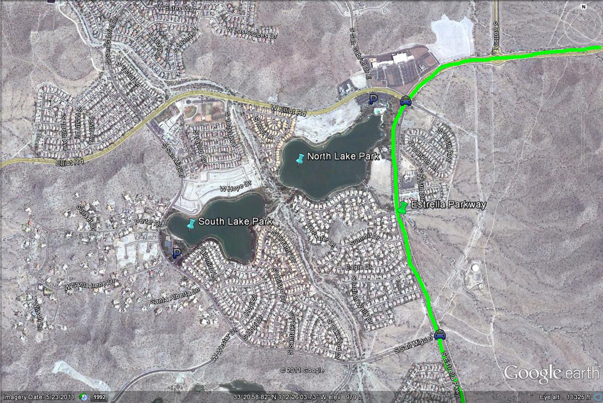
Map # 1: Overlook of the Estrella Lake Parks
From the 1-10 Freeway (West), take the Estrella Parkway exit south for 8.5 miles to the Estrella Mountain Lake Parks. Once being close to this spot, there are two lake parks, a north park and a south park. To view the north park, this spot is at the 8.5 mile mark when coming south from the 1-10 on Estrella Parkway. Make a right (west) on Elliot Road, where a noticable restaurant and park with basketball courts will be on the south side of Elliot. Park here and explore the lake on this north side of the park. To reach the south lake, continue west on Elliot Road for one mile until San Miguel Road is reached. At this intersection, turn left (south) on San Miguel Road for 0.6 miles until the south park is reached, which is very similiar to the north park. Another option to reach the south park would be to continue south past Elliot Road on Estrella Parkway for almost a mile until San Miguel is reached. Turn right (west) on San Miguel Rd for a little over a mile to reach the south lake park. Another cool thing about these parks is that they almost connect. If walking clearly around one of the lakes by following the paths, the paths cross over to the other park.
|


