Encanto Park Maps
*All maps by Google.
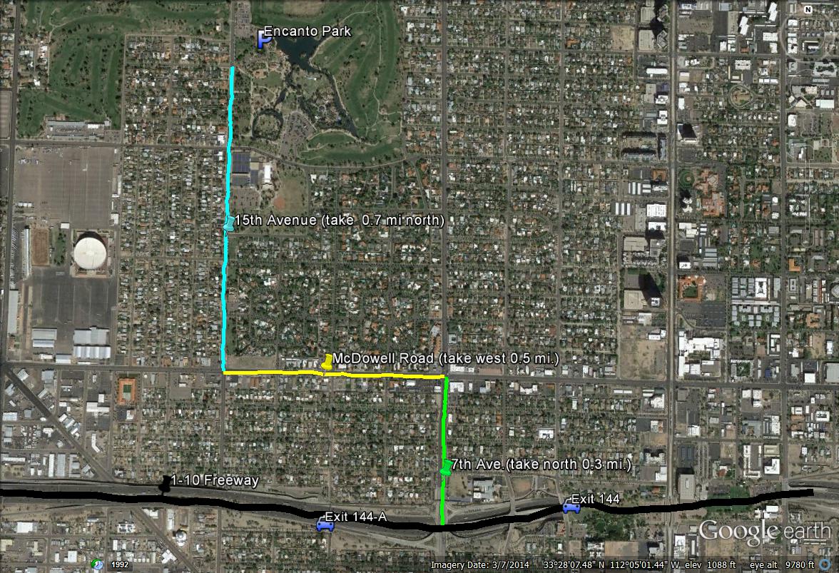
Map # 1: Getting to Encanto Park
If on the 1-10 Freeway, take the 7th Avenue exit (Exit 144-A if coming eastbound on I-10, Exit 144 if coming westbound on I-10) and then 7th Avenue 0.3 miles north to McDowell Road, and then take McDowell west 0.5 miles to 15th Avenue. Turn north (right) on 15th Avenue and head north for 0.7 miles to the parking area for Encanto Park on the east side of 15th Avenue. This parking area is shortly north of Encanto Boulevard. Bigger bordering roads surrounding Encanto Park would be Thomas Road on the north, 19th Avenue on the west, McDowell Road on the south, and 7th Avenue on the east.
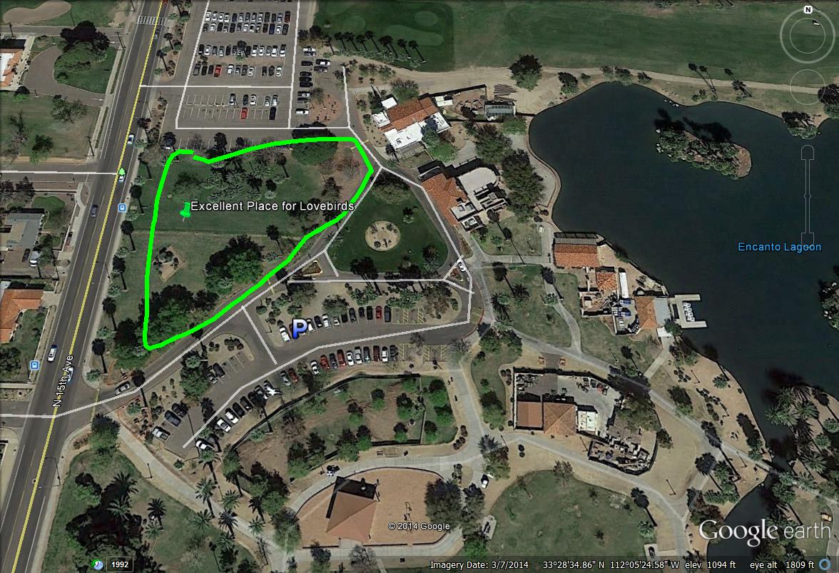
Map # 2: Close-up overview of the main part of Encanto Park with Rosy-faced Lovebird hotspot
Once parking at Encanto Park off of 15th Avenue (shortly north of Encanto Blvd. and 0.7 miles north of McDowell Road), especially bird in the area just north of the parking lot for the Rosy-faced Lovebirds. They are usually seen and heard within seconds!
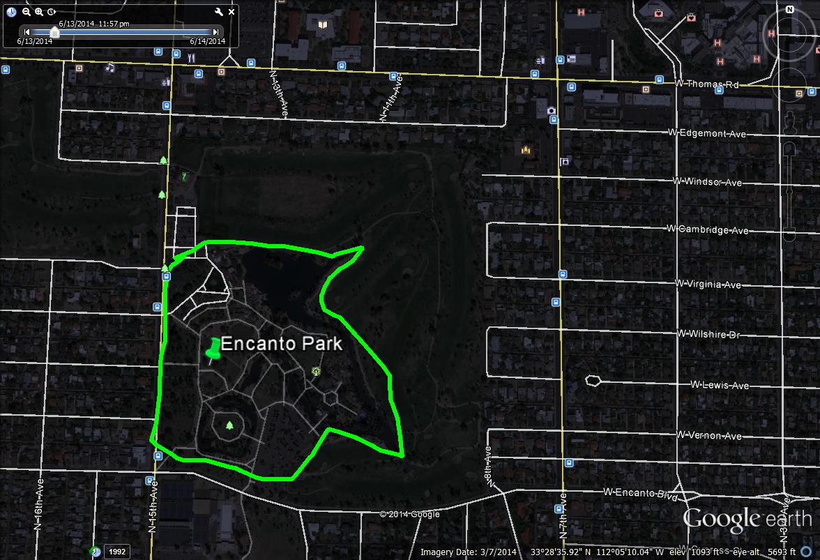
Map # 3: Encanto Park Overview
| 

