El Rio Research Area Maps
*All maps property of Google.
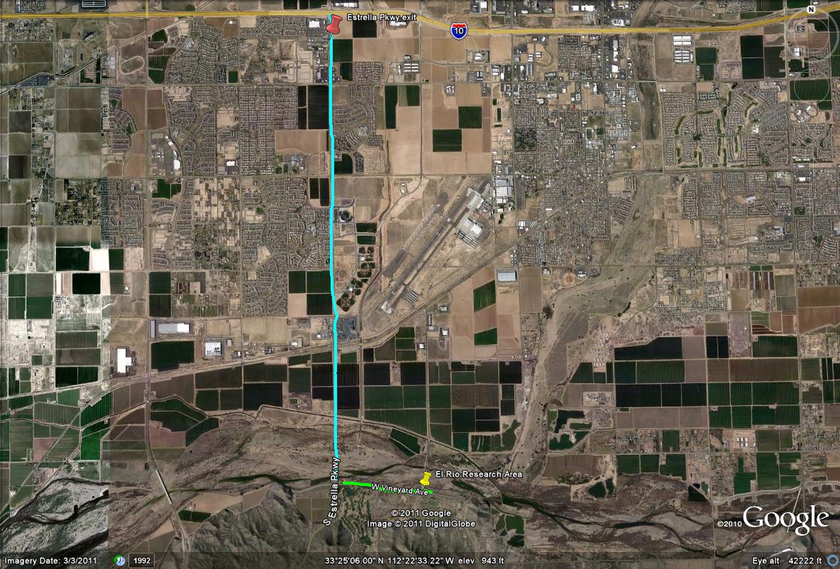
Map # 1: Route to the El Rio Research Area
By taking the I-10 West to the Estrella Parkway Exit is the way to get to El Rio. Take Estrella Parkway south for five miles until it reaches W. Vineyard Avenue. Then take Vineyard Avenue east for a mile to the research area, which the parking area is located just east of Bullard Avenue at the northeast corner of Bullard and Vineyard Avenues. This area can also be accessed by Bullard Avenue if taking Bullard south from the M-C 85.
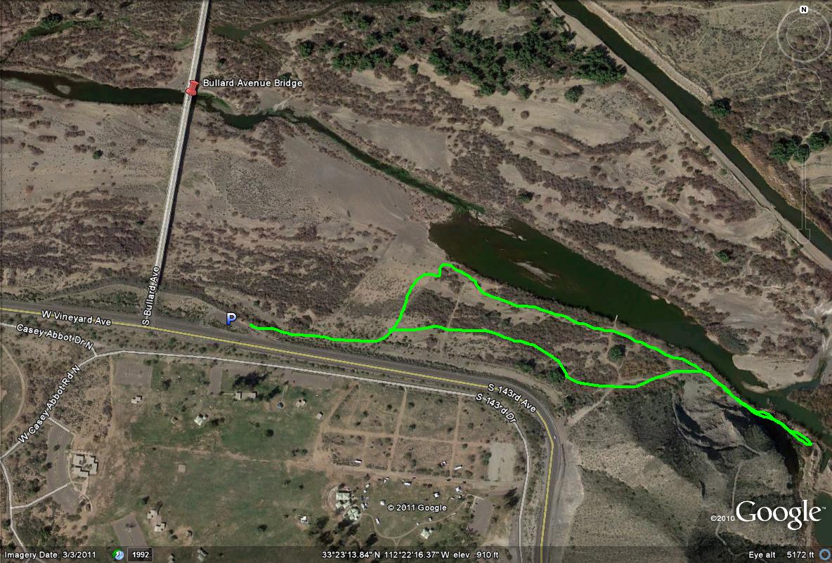
Map # 2: El Rio Research Area overview
The lime green path and lines illustrate the trails that can be birded here at the El Rio Research Area.
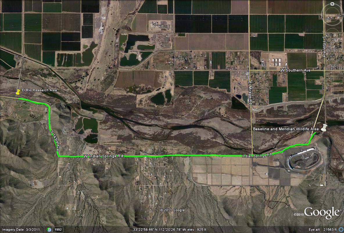
Map # 3: If coming from Tres Rios or Baseline and Meridian Wildlife Area
A 4.5 mile route from Baseline and Meridian Wildlife Area west to the El Rio Research Area. 115th Avenue (Avondale Blvd.) turns into Indian Springs Road, which eventually turns north onto 143rd Avenue turning north. That eventually turns west on Vineyard Avenue, which shortly comes across to the El Rio Research Area. It is located just east of Bullard Avenue on the northeast corner of Bullard and Vineyard Avenues.
| 

