Duncan and Franklin Area Maps
NOTE: *All maps are owned by Google and Google Earth.
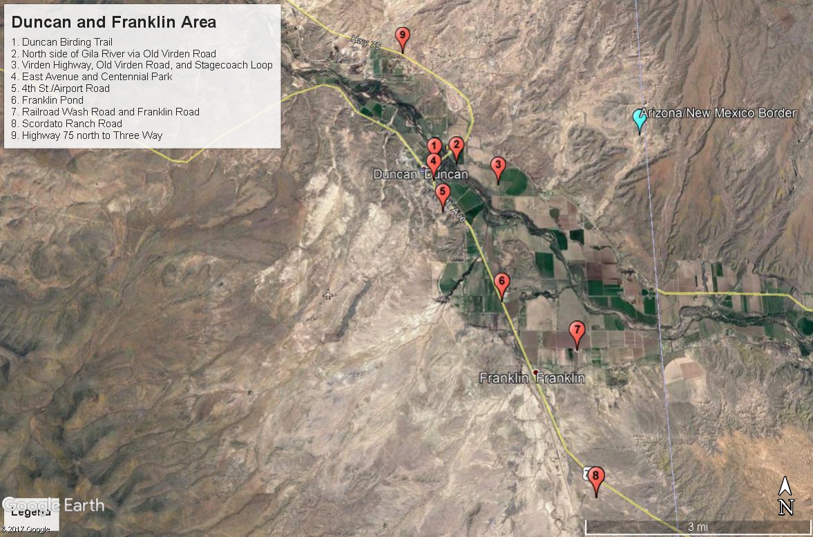
This is the maps section for the Duncan and Franklin Birding area. There are 9 birding locations that fall within this area. Most of them are very easy to bird and don't require detailed map overviews. The maps here show locations that may be good to have map overviews for.
Map # 1: Overview of Duncan and Franklin Area
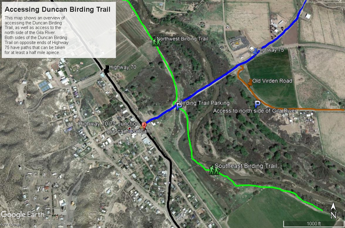
Map # 2: Duncan Birding Trail and Gila River north access and overview map
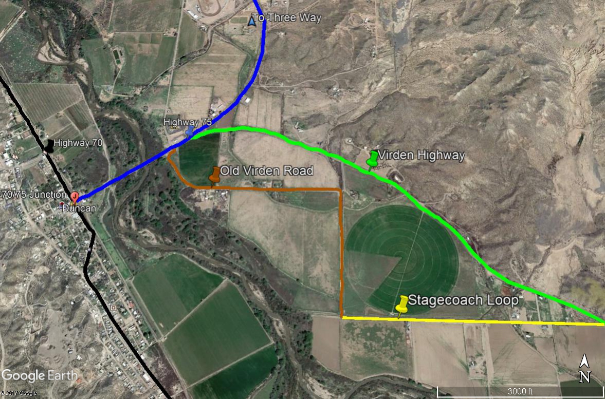
Map # 3: Overview of Virden Highway, Stagecoach Loop, and Old Virden Road loop drive in relation to base location for directions of Highway 70 and 75.
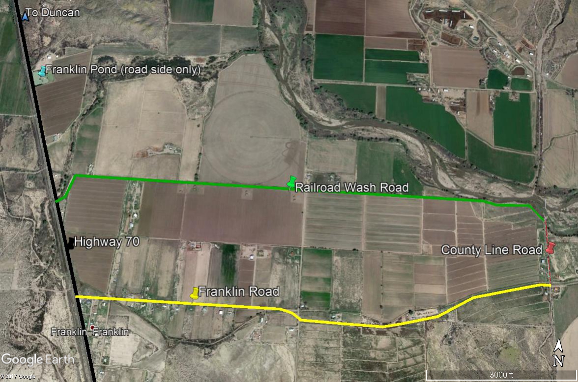
Map # 4: Overview of Franklin Pond and Railroad Wash and Franklin Roads.
This route is very easy to bird. The pond is usually a quick stop. Railroad Wash Road connects to Franklin Road to the south and east by taking County Line Road 0.3 miles south to Franklin Road. Taking Franklin Road back to Highway 70 creates a convenient loop drive. Anything east of County Line Road is out of Arizona and Greenlee County and falls into New Mexico.
Back to Duncan and Franklin Area | 

