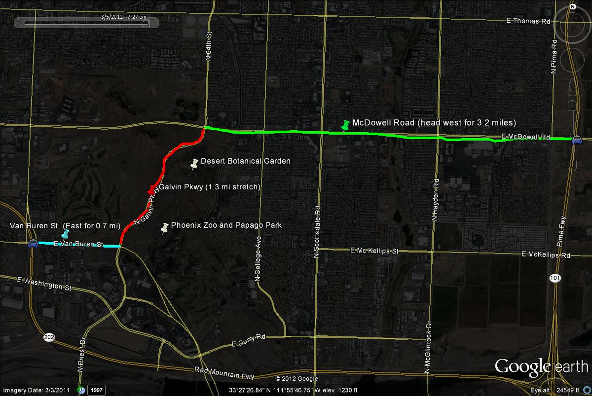
The Desert Botanical Gardens, Papago Park, and the Phoenix Zoo are all located in very close range of each other. They can all be reached from Galvin Parkway (which shortly south becomes Priest Drive). Galvin Parkway is bordered by McDowell Road on the north, E Van Buren Street/Mill Avenue on the south, as well as roads nearby such as 48th and 52nd streets on the west and Scottsdale and Hayden Roads on the east. McDowell Road is the best way to access these three spots. These locations are also easy to reach from both the Loop 101 (Pima Freeway) and Loop 202 (Red Mountain Freeway) Freeways. From the Loop 101, take the McDowell Road exit. Head west for 3.2 miles on McDowell, and then turn south on Galvin Parkway. Once on Galvin Parkway, head south shortly to the Desert Botanical Garden turnoff. From the Loop 202, take the Van Buren Street exit. Head east on Van Buren (which shortly turns into Mill Avenue) for 0.7 miles to Galvin Parkway. Head north on Galvin Parkway for a very short distance to the turnoff to Desert Botanical Garden on the east side of the road.