Coon Bluff Recreation Site Map
*All maps property of Google
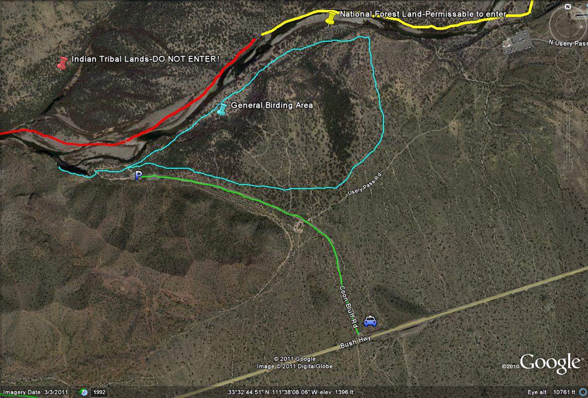
Lime-green path/line: Shows the entrance road to Coon Bluff, which is just over a mile in length. Good birding oppurtunities present themselves along this road.
Light-blue path/lines: Shows the general birding area in the Coon Bluff Recreation Site, whether exploring the many side trails or right along the river. Most of the birding lies east of the parking lot, with limited but good habitat to the west.
Red path/line: Shows the general area of the Indian Tribal Lands, so don't bird on this stretch of the north side of the Salt River.
Yellow Path/line: In the general area east of the parking lot, crossing the Salt River and birding on the north side is permissable, due to the fact this is now National Forest Land. Consult a map for exact distances and lengths.
| 

