Box Bar Recreation Site Maps
*All maps property of Google
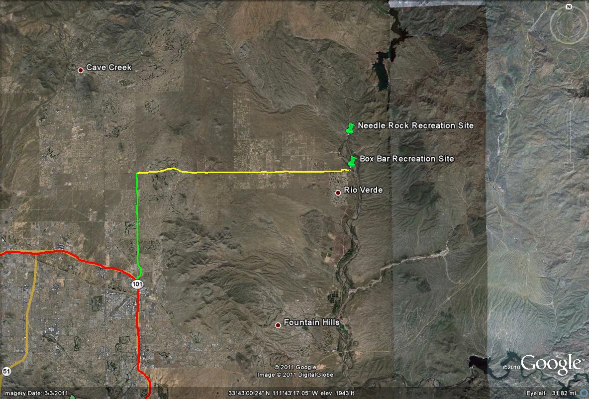
Map # 1: Getting to the Box Bar Recreation Site
From the Loop 101-East (Pima Freeway), take Pima Road north for 6.7 miles to E. Dynamite Blvd. Once at E. Dynamite Blvd, head east (turn right), for about 13 miles. Dynamite Blvd turns into E Rio Verde Drive and at about 13 miles, Rio Verde Drive reaches it's end and intersects with N. Fort McDowell Road south of Rio Verde Drive, and N. Forest Road north of Rio Verde Drive. Fort McDowell Road turns into N. Forest Road. Head north shortly (left turn) on N. Forest Road for 0.1 miles and turn east (right) onto Box Bar Road. Follow Box Bar Road for 0.7 miles to the parking area at the recreation site.
Key:
Red line/path: Loop 101 East
Lime green path: N. Pima Road
Yellow path: E. Dynamite Blvd, which turns into E. Rio Verde Drive
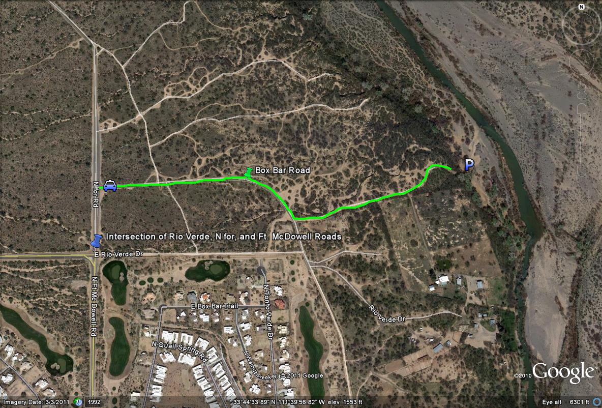
Map # 2: Turning off and parking at the Box Bar Recreation Site
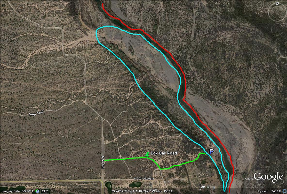
Map # 3: Birding the Box Bar Recreation Site
Key:
Light-blue path: Shows the best birding routes in this circular area, which has the great cottonwood and willow stands all throughout
Red lines: Show the closed area on the east side of the Verde River due to nesting Bald Eagles. Don't enter east of this area December 1st through June 30th annually.
| 

